


MONT CENIS_Col de Sollières_fort de Montfroid

m261212
User
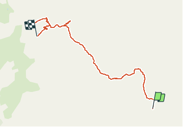

Length
8 km

Max alt
2785 m

Uphill gradient
697 m
Km-Effort
15.7 km

Min alt
2115 m

Downhill gradient
207 m
Boucle
No
Creation date :
2020-06-26 13:21:44.546
Updated on :
2020-06-26 14:20:53.016
2h17
Difficulty : Medium

FREE GPS app for hiking
 SityTrail
IGN / Geographical institutes
SityTrail Plus
The world is yours!
About
Trail Walking of 8 km to be discovered at Auvergne-Rhône-Alpes, Savoy, Val-Cenis. This trail is proposed by m261212.
Positioning
Country:
France
Region :
Auvergne-Rhône-Alpes
Department/Province :
Savoy
Municipality :
Val-Cenis
Location:
Bramans
Start:(Dec)
Start:(UTM)
333915 ; 5009323 (32T) N.
Comments