


2020-07-01 Au-dessus de St Jean

Bernardb44
User

Length
3.6 km

Max alt
1239 m

Uphill gradient
76 m
Km-Effort
4.6 km

Min alt
1170 m

Downhill gradient
79 m
Boucle
Yes
Creation date :
2020-07-01 13:59:51.556
Updated on :
2020-07-01 14:58:03.027
57m
Difficulty : Very easy

FREE GPS app for hiking
 SityTrail
IGN / Geographical institutes
SityTrail Plus
The world is yours!
About
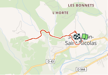
Trail Walking of 3.6 km to be discovered at Provence-Alpes-Côte d'Azur, Hautes-Alpes, Saint-Jean-Saint-Nicolas. This trail is proposed by Bernardb44.
Positioning
Country:
France
Region :
Provence-Alpes-Côte d'Azur
Department/Province :
Hautes-Alpes
Municipality :
Saint-Jean-Saint-Nicolas
Location:
Unknown
Start:(Dec)
Start:(UTM)
279378 ; 4949968 (32T) N.
Comments