Trail Cycle Saint-Nizier-le-Bouchoux - Mépillat 45km - Photo
© OpenStreetMap contributors
Length
Length
45 km
Max alt
Max alt
234 m
Uphill gradient
Uphill gradient
417 m
Km-Effort
Km-Effort  
50 km
Min alt
Min alt
185 m
Downhill gradient
Downhill gradient
417 m
Boucle
Boucle
Yes
Creation date :
2020-07-02 04:50:19.756
Updated on :
2021-06-13 13:19:20.091

(0 Reviews)

Cycle
Cycle
3h00
Difficulty : Easy

Scan this QR Code to open this trail in the SityTrail application

FREE GPS app for hiking

Logo SityTrail SityTrail

IGN / Geographical institutes

Download SityTrail from the App Store Download SityTrail from Google Play

Logo SityTrail SityTrail World

The world is yours!

Download SityTrail from the App Store Download SityTrail from Google Play Download SityTrail on Huawei AppGallery

About

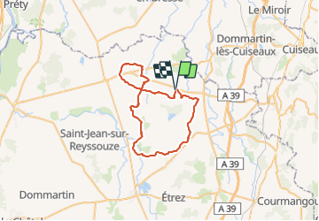
Trail Cycle of 45 km to be discovered at Auvergne-Rhône-Alpes, Ain, Saint-Nizier-le-Bouchoux. This trail is proposed by Mariolebeno.

Elevation profile

Positioning

Country:
France
Region :
Auvergne-Rhône-Alpes
Department/Province :
Ain
Municipality :
Saint-Nizier-le-Bouchoux
Location:
Unknown
Start:(UTM)
668174 ; 5146448 (31T) N.

Trails nearby

Trail Walking Lescheroux -  - Photo
Walking
frederic.vibert

Walking

Very easy
Lescheroux, Auvergne-Rhône-Alpes, Ain, France
14 km | 15.6 km-effort
Unknown
Yes


Close
My subscriptions