


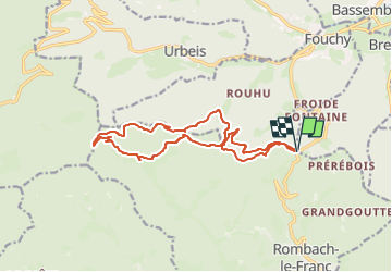
Col de Fouchy - Hingrie

RUHLMANN
User

Length
14.5 km

Max alt
816 m

Uphill gradient
686 m
Km-Effort
24 km

Min alt
490 m

Downhill gradient
687 m
Boucle
Yes
Creation date :
2020-07-02 16:25:10.578
Updated on :
2024-06-12 17:10:05.487
5h23
Difficulty : Medium

FREE GPS app for hiking
 SityTrail
IGN / Geographical institutes
SityTrail Plus
The world is yours!
About
Trail On foot of 14.5 km to be discovered at Grand Est, Haut-Rhin, Rombach-le-Franc. This trail is proposed by RUHLMANN.
Positioning
Country:
France
Region :
Grand Est
Department/Province :
Haut-Rhin
Municipality :
Rombach-le-Franc
Location:
Unknown
Start:(Dec)
Start:(UTM)
370986 ; 5351634 (32U) N.
Comments