Trail Other activity Evolène - Dent Blanche  Salay -refuge - Photo

Dent Blanche Salay -refuge

 tello
tello

User

© OpenStreetMap contributors
Length
Length
5.9 km
Max alt
Max alt
3530 m
Uphill gradient
Uphill gradient
1644 m
Km-Effort
Km-Effort  
22 km
Min alt
Min alt
1876 m
Downhill gradient
Downhill gradient
1 m
Boucle
Boucle
No
Creation date :
2014-12-11 00:00:00.0
Updated on :
2014-12-11 00:00:00.0

(0 Reviews)

Other activity
Other activity
--
Difficulty : Unknown

Scan this QR Code to open this trail in the SityTrail application

FREE GPS app for hiking

Logo SityTrail SityTrail

IGN / Geographical institutes

Download SityTrail from the App Store Download SityTrail from Google Play

Logo SityTrail SityTrail World

The world is yours!

Download SityTrail from the App Store Download SityTrail from Google Play Download SityTrail on Huawei AppGallery

About

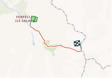
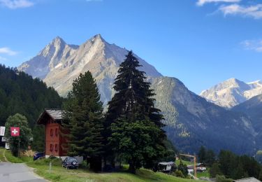
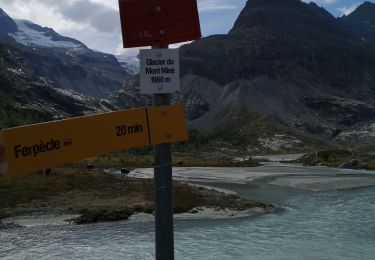
Trail Other activity of 5.9 km to be discovered at Valais/Wallis, Hérens, Evolène. This trail is proposed by tello.

Description

1er jour

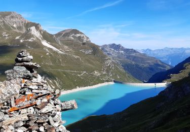
Montée au refuge depuis Salay

Elevation profile

Positioning

Country:
Switzerland
Region :
Valais/Wallis
Department/Province :
Hérens
Municipality :
Evolène
Location:
Unknown
Start:(UTM)
387869 ; 5101778 (32T) N.

Trails nearby

Trail Walking Anniviers - Cabane de Moiry - Zinal / Jour 7 - Photo
Walking
Greg813

Walking

Difficult
Anniviers, Valais/Wallis, Sierre, Switzerland
17.5 km | 30 km-effort
4h 59min
No
Trail Walking Evolène - CHX ZRMT Étape 7 de La Sage à Zinal  - Photo
Walking
jeff2

Walking

Medium
Evolène, Valais/Wallis, Hérens, Switzerland
25 km | 50 km-effort
7h 57min
No
Trail Walking Evolène - glacier mont miné  - Photo
Walking
vtaquin

Walking

Medium
Evolène, Valais/Wallis, Hérens, Switzerland
3.3 km | 6.5 km-effort
1h 31min
Yes
Trail Walking Evolène - La Sage – Cabane de Moiry / Jour 6 - Photo
Walking
Greg813

Walking

Difficult
Evolène, Valais/Wallis, Hérens, Switzerland
11.3 km | 30 km-effort
4h 26min
No
Trail Nordic walking Evolène - glacier Miné  - Photo
Nordic walking
suzanne.bron

Nordic walking

Very easy
Evolène, Valais/Wallis, Hérens, Switzerland
5.9 km | 8 km-effort
1h 56min
Yes
Trail Walking Evolène - vs_hike674d - Photo
Walking
GUIDE+

Walking

Very easy
Evolène, Valais/Wallis, Hérens, Switzerland
18 km | 41 km-effort
7h 2min
No
Trail Walking Evolène - bg_tsate - Photo
Walking
GUIDE+

Walking

Very easy
Evolène, Valais/Wallis, Hérens, Switzerland
3.6 km | 12.7 km-effort
2h 1min
No
Trail Nordic walking Evolène - arola  - Photo
Nordic walking
suzanne.bron

Nordic walking

Very easy
Evolène, Valais/Wallis, Hérens, Switzerland
10.2 km | 14.8 km-effort
2h 43min
No
Trail Nordic walking Evolène - descente de la cabane du tsa  - Photo
Nordic walking
suzanne.bron

Nordic walking

Very easy
Evolène, Valais/Wallis, Hérens, Switzerland
3.2 km | 5.8 km-effort
1h 14min
No


Close
My subscriptions