Cascade de Pitch par la Colette

soca
User

Length
21 km

Max alt
2240 m

Uphill gradient
930 m
Km-Effort
33 km

Min alt
1702 m

Downhill gradient
920 m
Boucle
Yes
Creation date :
2020-07-06 15:40:00.75
Updated on :
2020-07-06 15:41:41.371
6h50
Difficulty : Difficult

FREE GPS app for hiking
 SityTrail
IGN / Geographical institutes
SityTrail Plus
The world is yours!
About
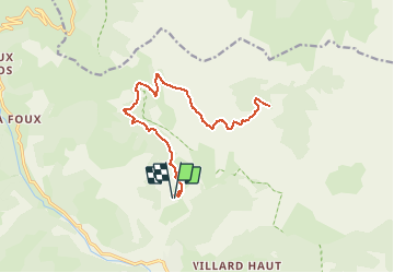
Trail Walking of 21 km to be discovered at Provence-Alpes-Côte d'Azur, Alpes-de-Haute-Provence, Allos. This trail is proposed by soca.
Positioning
Country:
France
Region :
Provence-Alpes-Côte d'Azur
Department/Province :
Alpes-de-Haute-Provence
Municipality :
Allos
Location:
Unknown
Start:(Dec)
Start:(UTM)
310664 ; 4903475 (32T) N.
Comments