


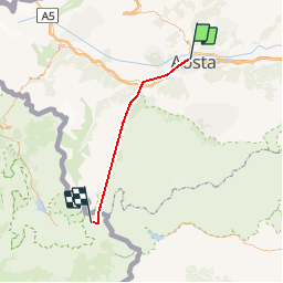
Aoste

tello
User

Length
40 km

Max alt
3066 m

Uphill gradient
3533 m
Km-Effort
81 km

Min alt
581 m

Downhill gradient
1725 m
Boucle
No
Creation date :
2014-12-11 00:00:00.0
Updated on :
2014-12-11 00:00:00.0
--
Difficulty : Unknown

FREE GPS app for hiking
 SityTrail
IGN / Geographical institutes
SityTrail Plus
The world is yours!
About
Trail Other activity of 40 km to be discovered at Aosta Valley, Unknown, Aosta. This trail is proposed by tello.
Description
Cabane Tracuit-Sommet Bishorn
Positioning
Country:
Italy
Region :
Aosta Valley
Department/Province :
Unknown
Municipality :
Aosta
Location:
Unknown
Start:(Dec)
Start:(UTM)
368571 ; 5066701 (32T) N.
Comments