


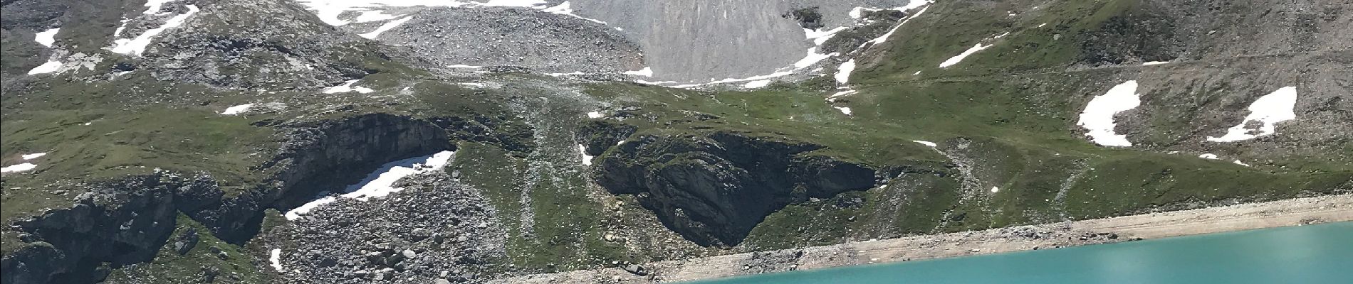
Réserve de la sassiere

Klhn
User
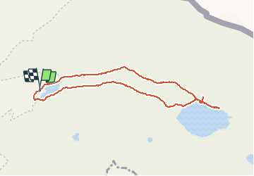

Length
8.5 km

Max alt
2489 m

Uphill gradient
256 m
Km-Effort
11.9 km

Min alt
2278 m

Downhill gradient
257 m
Boucle
Yes
Creation date :
2020-07-08 09:33:52.0
Updated on :
2020-07-08 15:20:59.235
2h42
Difficulty : Easy

FREE GPS app for hiking
 SityTrail
IGN / Geographical institutes
SityTrail Plus
The world is yours!
About
Trail Walking of 8.5 km to be discovered at Auvergne-Rhône-Alpes, Savoy, Tignes. This trail is proposed by Klhn.
Description
Le temps tient compte des nombreuses pauses marmottes 😍
Photos


Positioning
Country:
France
Region :
Auvergne-Rhône-Alpes
Department/Province :
Savoy
Municipality :
Tignes
Location:
Unknown
Start:(Dec)
Start:(UTM)
341258 ; 5039050 (32T) N.
Comments