


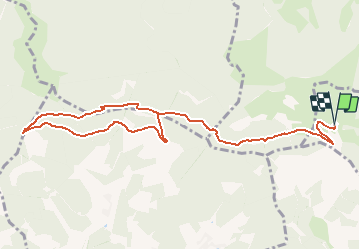
Parking FA du Lochberg - Col de Hirtzelach - Col du Chantoiseau - Col sans nom et retour

patrickbeyrath
User

Length
11.1 km

Max alt
1020 m

Uphill gradient
413 m
Km-Effort
16.6 km

Min alt
859 m

Downhill gradient
414 m
Boucle
Yes
Creation date :
2020-07-11 05:51:50.658
Updated on :
2020-07-11 06:09:09.325
--
Difficulty : Medium

FREE GPS app for hiking
 SityTrail
IGN / Geographical institutes
SityTrail Plus
The world is yours!
About
Trail On foot of 11.1 km to be discovered at Grand Est, Haut-Rhin, Kirchberg. This trail is proposed by patrickbeyrath.
Positioning
Country:
France
Region :
Grand Est
Department/Province :
Haut-Rhin
Municipality :
Kirchberg
Location:
Unknown
Start:(Dec)
Start:(UTM)
343719 ; 5293985 (32T) N.
Comments