


2020-07-11 Croix st Philippe

Bernardb44
User
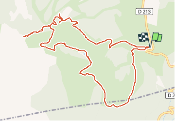

Length
7.2 km

Max alt
1704 m

Uphill gradient
220 m
Km-Effort
10.1 km

Min alt
1523 m

Downhill gradient
219 m
Boucle
Yes
Creation date :
2020-07-11 08:19:14.712
Updated on :
2020-07-11 12:21:59.643
4h01
Difficulty : Easy

FREE GPS app for hiking
 SityTrail
IGN / Geographical institutes
SityTrail Plus
The world is yours!
About
Trail Walking of 7.2 km to be discovered at Provence-Alpes-Côte d'Azur, Hautes-Alpes, Ancelle. This trail is proposed by Bernardb44.
Positioning
Country:
France
Region :
Provence-Alpes-Côte d'Azur
Department/Province :
Hautes-Alpes
Municipality :
Ancelle
Location:
Unknown
Start:(Dec)
Start:(UTM)
279384 ; 4942261 (32T) N.
Comments