


Moosch-Blaufels

JCLUTT
User
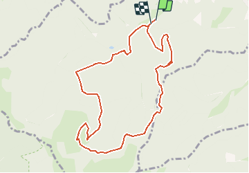

Length
9.5 km

Max alt
1031 m

Uphill gradient
579 m
Km-Effort
17.2 km

Min alt
469 m

Downhill gradient
573 m
Boucle
Yes
Creation date :
2020-07-15 14:57:15.795
Updated on :
2020-07-17 16:01:00.11
3h27
Difficulty : Difficult

FREE GPS app for hiking
 SityTrail
IGN / Geographical institutes
SityTrail Plus
The world is yours!
About
Trail Walking of 9.5 km to be discovered at Grand Est, Haut-Rhin, Moosch. This trail is proposed by JCLUTT.
Description
Une randonnée bien sportive avec une vue superbe depuis le Blaufels !
Positioning
Country:
France
Region :
Grand Est
Department/Province :
Haut-Rhin
Municipality :
Moosch
Location:
Unknown
Start:(Dec)
Start:(UTM)
352638 ; 5301490 (32T) N.
Comments