


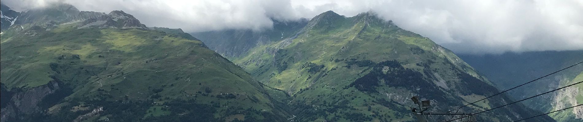
Balade aux arcs par le funiculaire de bourg

Klhn
User
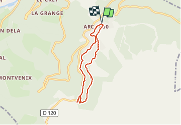

Length
6.1 km

Max alt
1791 m

Uphill gradient
219 m
Km-Effort
9 km

Min alt
1617 m

Downhill gradient
218 m
Boucle
Yes
Creation date :
2020-07-16 12:50:08.0
Updated on :
2020-07-16 14:44:42.121
1h55
Difficulty : Easy

FREE GPS app for hiking
 SityTrail
IGN / Geographical institutes
SityTrail Plus
The world is yours!
About
Trail Walking of 6.1 km to be discovered at Auvergne-Rhône-Alpes, Savoy, Bourg-Saint-Maurice. This trail is proposed by Klhn.
Photos

Positioning
Country:
France
Region :
Auvergne-Rhône-Alpes
Department/Province :
Savoy
Municipality :
Bourg-Saint-Maurice
Location:
Unknown
Start:(Dec)
Start:(UTM)
328024 ; 5051603 (32T) N.
Comments