Trail Road bike Touët-sur-Var - Circuit_d_couverte_des_gorges_rouges_ - Photo

Circuit_d_couverte_des_gorges_rouges_

 rubentha
rubentha

User

© OpenStreetMap contributors
Length
Length
88 km
Max alt
Max alt
1680 m
Uphill gradient
Uphill gradient
2493 m
Km-Effort
Km-Effort  
121 km
Min alt
Min alt
332 m
Downhill gradient
Downhill gradient
2492 m
Boucle
Boucle
Yes
Creation date :
2020-07-16 18:42:30.853
Updated on :
2020-07-16 18:49:35.534

(0 Reviews)

Road bike
Road bike
6h50
Difficulty : Very difficult

Scan this QR Code to open this trail in the SityTrail application

FREE GPS app for hiking

Logo SityTrail SityTrail

IGN / Geographical institutes

Download SityTrail from the App Store Download SityTrail from Google Play

Logo SityTrail SityTrail World

The world is yours!

Download SityTrail from the App Store Download SityTrail from Google Play Download SityTrail on Huawei AppGallery

About

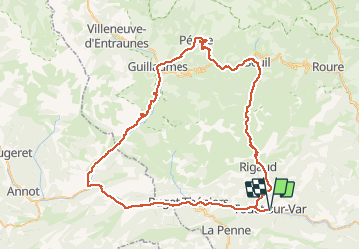
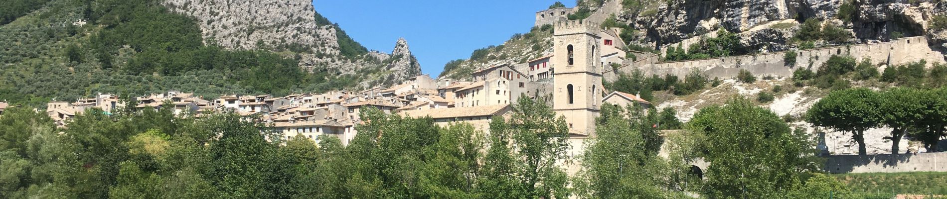
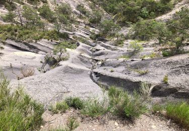
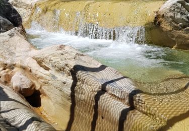
Trail Road bike of 88 km to be discovered at Provence-Alpes-Côte d'Azur, Maritime Alps, Touët-sur-Var. This trail is proposed by rubentha.

Description

- Tiré d'un dépliant du conseil général.
- Le dénivelé positif réel est dans les 1500m.

Elevation profile

Photos

Positioning

Country:
France
Region :
Provence-Alpes-Côte d'Azur
Department/Province :
Maritime Alps
Municipality :
Touët-sur-Var
Location:
Unknown
Start:(UTM)
340178 ; 4868011 (32T) N.

Trails nearby

Trail Walking Touët-sur-Var - Touet sur Var - Photo
Walking
Renefrt

Walking

Medium
Touët-sur-Var, Provence-Alpes-Côte d'Azur, Maritime Alps, France
9.8 km | 15.8 km-effort
6h 12min
Yes
Trail Walking Thiéry - Brec d’ Ilonse - Photo
Walking
bozo1970

Walking

Easy
Thiéry, Provence-Alpes-Côte d'Azur, Maritime Alps, France
9.6 km | 17.5 km-effort
2h 49min
Yes
Trail Walking Thiéry - thiery Villa Soubere - Photo
Walking
Renefrt

Walking

Medium
Thiéry, Provence-Alpes-Côte d'Azur, Maritime Alps, France
7.9 km | 15.2 km-effort
5h 13min
Yes
Trail Walking Ascros - ascros - Photo
Walking
Renefrt

Walking

Medium
Ascros, Provence-Alpes-Côte d'Azur, Maritime Alps, France
10.6 km | 15.7 km-effort
6h 31min
Yes
Trail Walking Pierrefeu - mont brune  - Photo
Walking
Mariephil

Walking

Difficult
Pierrefeu, Provence-Alpes-Côte d'Azur, Maritime Alps, France
8 km | 13.7 km-effort
3h 13min
Yes
Trail Walking Thiéry - mont fracha et brec d illons  - Photo
Walking
Mariephil

Walking

Very difficult
(1)
Thiéry, Provence-Alpes-Côte d'Azur, Maritime Alps, France
10.3 km | 19.3 km-effort
4h 25min
Yes
Trail On foot Touët-sur-Var - Traversée Touët-sur-Var – Villars-sur-Var - Photo
On foot
PRO

On foot

Medium
Touët-sur-Var, Provence-Alpes-Côte d'Azur, Maritime Alps, France
13.9 km | 25 km-effort
5h 35min
No
Trail Walking Thiéry - Le Brec d'Ilonse depuis Thiery - Photo
Walking
ETMU5496

Walking

Difficult
Thiéry, Provence-Alpes-Côte d'Azur, Maritime Alps, France
18.4 km | 33 km-effort
5h 20min
Yes
Trail Walking Touët-sur-Var - Touet sur Var vers Villars sur Var - Photo
Walking
patsure

Walking

Medium
Touët-sur-Var, Provence-Alpes-Côte d'Azur, Maritime Alps, France
15.6 km | 28 km-effort
4h 45min
No


Close
My subscriptions