Trail Walking Vilcey-sur-Trey - Vilcey sur Trey - Photo
 Greg813
Greg813

User

© OpenStreetMap contributors
Length
Length
17.2 km
Max alt
Max alt
362 m
Uphill gradient
Uphill gradient
340 m
Km-Effort
Km-Effort  
22 km
Min alt
Min alt
226 m
Downhill gradient
Downhill gradient
347 m
Boucle
Boucle
Yes
Creation date :
2020-07-17 14:09:39.53
Updated on :
2020-07-21 16:27:29.146

(0 Reviews)

Walking
Walking
4h50
Difficulty : Difficult

Scan this QR Code to open this trail in the SityTrail application

FREE GPS app for hiking

Logo SityTrail SityTrail

IGN / Geographical institutes

Download SityTrail from the App Store Download SityTrail from Google Play

Logo SityTrail SityTrail World

The world is yours!

Download SityTrail from the App Store Download SityTrail from Google Play Download SityTrail on Huawei AppGallery

About

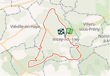
Trail Walking of 17.2 km to be discovered at Grand Est, Meurthe-et-Moselle, Vilcey-sur-Trey. This trail is proposed by Greg813.

Description

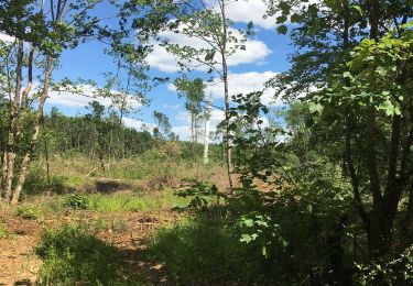
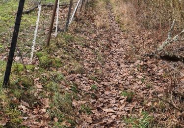
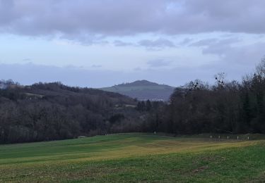
Randonnée dans les forêts jouxtant Vilcey sur Trey.
Passage par les vestiges des positions allemandes de la première guerre mondiale.
Les chemins sont assez dégagés et bien entretenus.

Elevation profile

Photos

Positioning

Country:
France
Region :
Grand Est
Department/Province :
Meurthe-et-Moselle
Municipality :
Vilcey-sur-Trey
Location:
Unknown
Start:(UTM)
717681 ; 5424491 (31U) N.

Trails nearby

Trail Mountain bike Pont-à-Mousson - Pose balises V3 - Photo
Mountain bike
PhilippeC54

Mountain bike

Medium
(1)
Pont-à-Mousson, Grand Est, Meurthe-et-Moselle, France
19.9 km | 26 km-effort
2h 1min
No
Trail Walking Montauville - AUDAX PONT A MOUSSON SI SEC - Photo
Walking
Toyot 8

Walking

Difficult
(1)
Montauville, Grand Est, Meurthe-et-Moselle, France
50 km | 60 km-effort
13h 35min
Yes
Trail Walking Prény - Forêt de Preny dévastée quelle dommage - Photo
Walking
bitiba

Walking

Medium
Prény, Grand Est, Meurthe-et-Moselle, France
7.4 km | 9.7 km-effort
1h 14min
No
Trail Mountain bike Vilcey-sur-Trey - Les villages du Saillant de St-Mihiel, aux portes de Pontà-Mousson. - Circuit n° 12 - Photo
Mountain bike
tracegps

Mountain bike

Difficult
Vilcey-sur-Trey, Grand Est, Meurthe-et-Moselle, France
47 km | 56 km-effort
2h 30min
Yes
Trail Walking Maidières - Maidieres - Boucle des vergers - variante - Photo
Walking
jean-marie.parachini

Walking

Medium
Maidières, Grand Est, Meurthe-et-Moselle, France
6.4 km | 8.7 km-effort
2h 1min
Yes
Trail Walking Maidières - Maidières Poterosse chemin de la croix robert GR5 Prochebois - Photo
Walking
jean-marie.parachini

Walking

Medium
Maidières, Grand Est, Meurthe-et-Moselle, France
4 km | 5.8 km-effort
1h 30min
Yes
Trail Walking Montauville - montauville - père hilarion - Photo
Walking
jean-marie.parachini

Walking

Easy
Montauville, Grand Est, Meurthe-et-Moselle, France
10.2 km | 12.8 km-effort
3h 56min
Yes
Trail Walking Montauville - Le père Hilarion Montauville  - Photo
Walking
jean-marie.parachini

Walking

Easy
Montauville, Grand Est, Meurthe-et-Moselle, France
6.6 km | 8.6 km-effort
2h 44min
Yes
Trail Walking Montauville - Bois le Prêtre Le 09/09/2023 - Photo
Walking
Andr00d

Walking

Medium
(1)
Montauville, Grand Est, Meurthe-et-Moselle, France
9.9 km | 12.3 km-effort
2h 30min
Yes


Close
My subscriptions