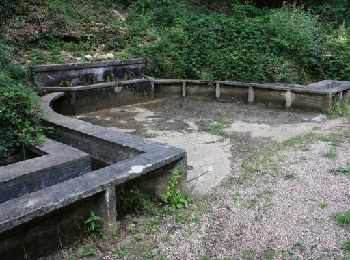
Vilcey-sur-Trey, Meurthe-et-Moselle: Best trails, routes and walks

Vilcey-sur-Trey: Discover the best trails: 3 hiking trails and 3 bike and mountain-bike routes. All these trails, routes and outdoor activities are available in our SityTrail applications for smartphones and tablets.


The best trails (6)

Trail Mountain bike Vilcey-sur-Trey - Les villages du Saillant de St-Mihiel, aux portes de Pontà-Mousson. - Circuit n° 12 - Photo
Mountain bike 47.174
Km

Mountain bike

Difficult
Vilcey-sur-Trey, Grand Est, Meurthe-et-Moselle, France
47 km | 56 km-effort
2h 30min
659 m
654 m
Yes
tracegps

Trail Walking Vilcey-sur-Trey - Vilcey sur Trey - Photo
Walking 17.23
Km

Walking

Difficult
Vilcey-sur-Trey, Grand Est, Meurthe-et-Moselle, France
17.2 km | 22 km-effort
4h 50min
340 m
347 m
Yes
Greg813

Trail Walking Vilcey-sur-Trey - Vilcey-sur-Trey - Photo
Walking 15.176
Km

Walking

Difficult
Vilcey-sur-Trey, Grand Est, Meurthe-et-Moselle, France
15.2 km | 18.7 km-effort
4h 6min
264 m
264 m
Yes
grandville

Trail Mountain bike Vilcey-sur-Trey - mussi - Photo
Mountain bike 20.857
Km

Mountain bike

Medium
Vilcey-sur-Trey, Grand Est, Meurthe-et-Moselle, France
21 km | 28 km-effort
2h 7min
530 m
566 m
No
nouga

Trail Walking Vilcey-sur-Trey - Vincent sur Trey Lion 4 goulots Vilcey - Photo
Walking 11.987
Km

Walking

Medium
Vilcey-sur-Trey, Grand Est, Meurthe-et-Moselle, France
12 km | 14.8 km-effort
3h 20min
212 m
215 m
Yes
pgydbt

Trail Cycle Vilcey-sur-Trey - Pont A Mousson Habaye Sainte Marie - Photo
Cycle 15.087
Km

Cycle

Medium
Vilcey-sur-Trey, Grand Est, Meurthe-et-Moselle, France
15.1 km | 19.1 km-effort
Unknown
304 m
306 m
Yes
patrick57

6 trails displayed on 6

FREE GPS app for hiking

Logo SityTrail SityTrail

IGN / Geographical institutes

Download SityTrail from the App Store Download SityTrail from Google Play

Logo SityTrail SityTrail World

The world is yours!

Download SityTrail from the App Store Download SityTrail from Google Play Download SityTrail on Huawei AppGallery

Activities

Close
My subscriptions