


84 Bedoin curnier chat malaval

Nathy8913
User

Length
17 km

Max alt
1069 m

Uphill gradient
907 m
Km-Effort
29 km

Min alt
429 m

Downhill gradient
911 m
Boucle
Yes
Creation date :
2020-07-20 07:21:57.292
Updated on :
2020-07-20 17:14:17.074
9h10
Difficulty : Difficult

FREE GPS app for hiking
 SityTrail
IGN / Geographical institutes
SityTrail Plus
The world is yours!
About
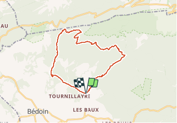
Trail Walking of 17 km to be discovered at Provence-Alpes-Côte d'Azur, Vaucluse, Bédoin. This trail is proposed by Nathy8913.
Positioning
Country:
France
Region :
Provence-Alpes-Côte d'Azur
Department/Province :
Vaucluse
Municipality :
Bédoin
Location:
Unknown
Start:(Dec)
Start:(UTM)
677163 ; 4889019 (31T) N.
Comments