


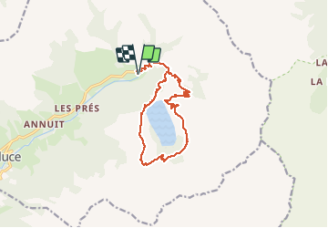
TOUR DU LAC DE LA GIROLLE PAR CHAUDANNE

jpb83
User

Length
14 km

Max alt
2052 m

Uphill gradient
916 m
Km-Effort
26 km

Min alt
1226 m

Downhill gradient
916 m
Boucle
Yes
Creation date :
2020-07-26 20:16:43.664
Updated on :
2020-07-26 20:17:46.621
5h16
Difficulty : Very difficult

FREE GPS app for hiking
 SityTrail
IGN / Geographical institutes
SityTrail Plus
The world is yours!
About
Trail Walking of 14 km to be discovered at Auvergne-Rhône-Alpes, Savoy, Hauteluce. This trail is proposed by jpb83.
Positioning
Country:
France
Region :
Auvergne-Rhône-Alpes
Department/Province :
Savoy
Municipality :
Hauteluce
Location:
Unknown
Start:(Dec)
Start:(UTM)
316559 ; 5071464 (32T) N.
Comments