Trail Walking Sentein - Chapelle de l'Isard - Photo

Chapelle de l'Isard

© OpenStreetMap contributors
Length
Length
12.4 km
Max alt
Max alt
1419 m
Uphill gradient
Uphill gradient
631 m
Km-Effort
Km-Effort  
21 km
Min alt
Min alt
826 m
Downhill gradient
Downhill gradient
631 m
Boucle
Boucle
Yes
Creation date :
2020-08-07 07:04:40.31
Updated on :
2020-08-16 15:03:46.558

(0 Reviews)

Walking
Walking
8h00
Difficulty : Medium

Scan this QR Code to open this trail in the SityTrail application

FREE GPS app for hiking

Logo SityTrail SityTrail

IGN / Geographical institutes

Download SityTrail from the App Store Download SityTrail from Google Play

Logo SityTrail SityTrail World

The world is yours!

Download SityTrail from the App Store Download SityTrail from Google Play Download SityTrail on Huawei AppGallery

About

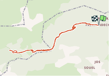
Trail Walking of 12.4 km to be discovered at Occitania, Ariège, Sentein. This trail is proposed by GuyVachet.

Description

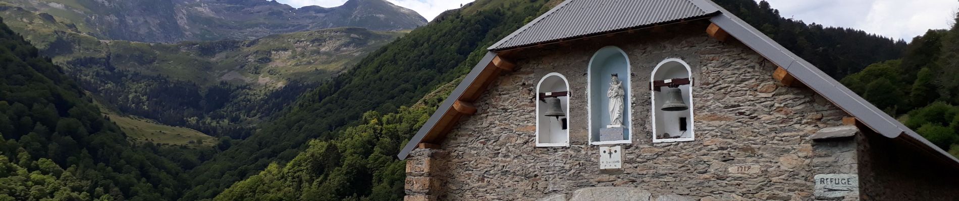
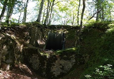
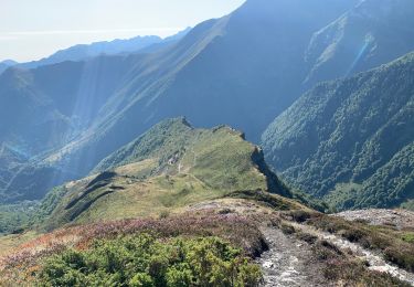
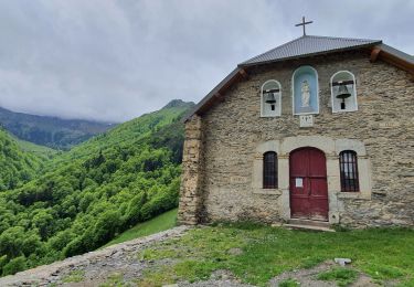
Aller-Retour pour la chapelle de l’Izard et en montant un peu plus haut, la sapinière et le ruisseau de la réserve biologique. L'itinéraire très rapidement en forêt rejoint le GR de Pays Tour du Biros en remontant l'Isard. Le sentier bien marqué est sans difficulté car il reste large la plupart du temps ce qui permet de s'affranchir du devers. La chapelle en cours de restauration est située en sortie de forêt et il est intéressant de poursuivre un peu pour remonter le cours du ruisseau jusqu'à une petite cascade à condition d'être équipé pour marcher dans l'eau et entre les rochers. Retour par le même itinéraire.

Elevation profile

Photos

Positioning

Country:
France
Region :
Occitania
Department/Province :
Ariège
Municipality :
Sentein
Location:
Unknown
Start:(UTM)
330780 ; 4748213 (31T) N.

Trails nearby

Trail Walking Sentein - M008-Frechendech à Etang ARAING - Photo
Walking
Polo-31

Walking

Difficult
(1)
Sentein, Occitania, Ariège, France
24 km | 44 km-effort
10h 0min
Yes
Trail Walking Sentein - Araing Crabère - Photo
Walking
Gepeto_22

Walking

Difficult
(2)
Sentein, Occitania, Ariège, France
32 km | 63 km-effort
9h 49min
No
Trail Walking Bonac-Irazein - tunnels du Biros ou sentier Decauville - Photo
Walking
chrisgps

Walking

Very difficult
Bonac-Irazein, Occitania, Ariège, France
17.8 km | 29 km-effort
6h 35min
Yes
Trail Walking Bonac-Irazein - Sentier du port d’Orle - col du Tuc - Photo
Walking
altaya

Walking

Easy
Bonac-Irazein, Occitania, Ariège, France
13.7 km | 27 km-effort
6h 20min
Yes
Trail Walking Sentein - 2022 TRANSPYRÉNÉEN :l’Etand d’Araing -Eylie le haut. - Photo
Walking
LEGUE

Walking

Difficult
Sentein, Occitania, Ariège, France
9.7 km | 18.1 km-effort
3h 15min
No
Trail Walking Balacet - Pic de l'Arraing - Photo
Walking
counoise

Walking

Medium
Balacet, Occitania, Ariège, France
11.9 km | 24 km-effort
4h 7min
Yes
Trail Walking Sentein - Cabane d'Illau et chapelle de l'izard  - Photo
Walking
chrisgps

Walking

Medium
(1)
Sentein, Occitania, Ariège, France
15.2 km | 26 km-effort
6h 46min
Yes
Trail Walking Antras - Le tour du Mail des  Morères - Photo
Walking
VACHER31

Walking

Easy
(1)
Antras, Occitania, Ariège, France
10.9 km | 22 km-effort
4h 30min
Yes
Trail Walking Sentein - Le tour du cirque de la plagne - Photo
Walking
patricklecetre

Walking

Medium
(2)
Sentein, Occitania, Ariège, France
10.3 km | 24 km-effort
4h 7min
Yes


Close
My subscriptions