


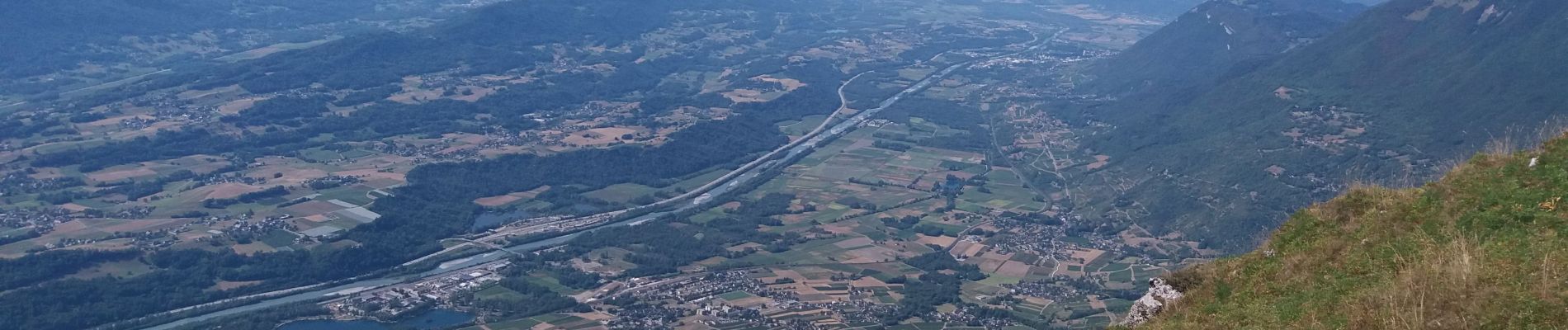
BAUGES: COL D'ARCLUSAZ

djeepee74
User
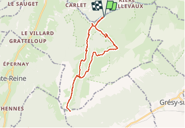

Length
15.8 km

Max alt
1777 m

Uphill gradient
966 m
Km-Effort
29 km

Min alt
864 m

Downhill gradient
962 m
Boucle
Yes
Creation date :
2020-08-08 06:11:49.749
Updated on :
2020-08-08 14:36:31.56
5h45
Difficulty : Difficult

FREE GPS app for hiking
 SityTrail
IGN / Geographical institutes
SityTrail Plus
The world is yours!
About
Trail Walking of 15.8 km to be discovered at Auvergne-Rhône-Alpes, Savoy, École. This trail is proposed by djeepee74.
Description
BOUCLE... live le 20200808
La descente, après le chalet de Bottier, à faire par temps sec... de préférence.
Photos


Positioning
Country:
France
Region :
Auvergne-Rhône-Alpes
Department/Province :
Savoy
Municipality :
École
Location:
Unknown
Start:(Dec)
Start:(UTM)
282151 ; 5057737 (32T) N.
Comments