


lac lautier / pas Olan / la chapelle

mthomas30
User

Length
14.3 km

Max alt
2743 m

Uphill gradient
614 m
Km-Effort
27 km

Min alt
1091 m

Downhill gradient
1897 m
Boucle
No
Creation date :
2020-08-09 07:02:36.482
Updated on :
2020-08-09 16:01:37.788
8h27
Difficulty : Difficult

FREE GPS app for hiking
 SityTrail
IGN / Geographical institutes
SityTrail Plus
The world is yours!
About
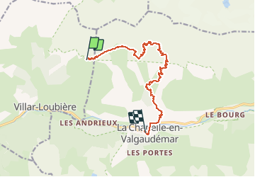
Trail Walking of 14.3 km to be discovered at Provence-Alpes-Côte d'Azur, Hautes-Alpes, Villar-Loubière. This trail is proposed by mthomas30.
Positioning
Country:
France
Region :
Provence-Alpes-Côte d'Azur
Department/Province :
Hautes-Alpes
Municipality :
Villar-Loubière
Location:
Unknown
Start:(Dec)
Start:(UTM)
275982 ; 4969315 (32T) N.
Comments