


Beaufortain J3

Airelle
User
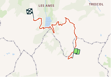

Length
13.5 km

Max alt
2327 m

Uphill gradient
810 m
Km-Effort
25 km

Min alt
1539 m

Downhill gradient
895 m
Boucle
No
Creation date :
2020-08-09 06:24:00.0
Updated on :
2020-08-14 14:48:05.255
6h55
Difficulty : Unknown

FREE GPS app for hiking
 SityTrail
IGN / Geographical institutes
SityTrail Plus
The world is yours!
About
Trail Walking of 13.5 km to be discovered at Auvergne-Rhône-Alpes, Savoy, Aime-la-Plagne. This trail is proposed by Airelle.
Positioning
Country:
France
Region :
Auvergne-Rhône-Alpes
Department/Province :
Savoy
Municipality :
Aime-la-Plagne
Location:
Granier
Start:(Dec)
Start:(UTM)
313501 ; 5054399 (32T) N.
Comments