


Le Col del Pam

richardsimopons
User

Length
6.9 km

Max alt
2009 m

Uphill gradient
190 m
Km-Effort
9.5 km

Min alt
1829 m

Downhill gradient
189 m
Boucle
Yes
Creation date :
2020-08-11 07:08:48.0
Updated on :
2020-08-11 09:24:16.457
2h01
Difficulty : Unknown

FREE GPS app for hiking
 SityTrail
IGN / Geographical institutes
SityTrail Plus
The world is yours!
About
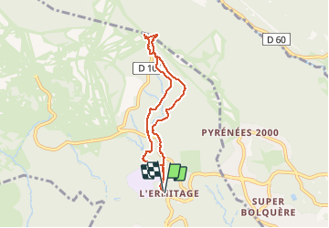
Trail Walking of 6.9 km to be discovered at Occitania, Pyrénées-Orientales, Font-Romeu-Odeillo-Via. This trail is proposed by richardsimopons.
Description
A partir de l’Ermitage: beau parcours jusqu’au Belvédère, ombragé.
Photos


Positioning
Country:
France
Region :
Occitania
Department/Province :
Pyrénées-Orientales
Municipality :
Font-Romeu-Odeillo-Via
Location:
Unknown
Start:(Dec)
Start:(UTM)
421591 ; 4707148 (31T) N.
Comments