


Thann-Chene Wotan

JCLUTT
User
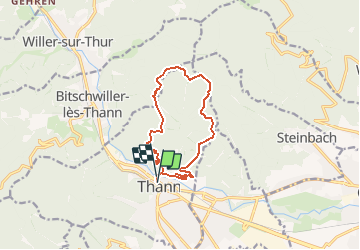

Length
11.3 km

Max alt
789 m

Uphill gradient
535 m
Km-Effort
18.4 km

Min alt
336 m

Downhill gradient
533 m
Boucle
Yes
Creation date :
2020-08-12 16:17:59.491
Updated on :
2020-08-12 16:21:43.759
3h46
Difficulty : Easy

FREE GPS app for hiking
 SityTrail
IGN / Geographical institutes
SityTrail Plus
The world is yours!
About
Trail Walking of 11.3 km to be discovered at Grand Est, Haut-Rhin, Thann. This trail is proposed by JCLUTT.
Positioning
Country:
France
Region :
Grand Est
Department/Province :
Haut-Rhin
Municipality :
Thann
Location:
Unknown
Start:(Dec)
Start:(UTM)
357875 ; 5297073 (32T) N.
Comments