


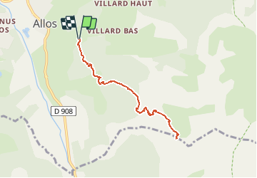
Allos - Roche Cline

soca
User

Length
8.2 km

Max alt
2375 m

Uphill gradient
834 m
Km-Effort
19.3 km

Min alt
1534 m

Downhill gradient
836 m
Boucle
Yes
Creation date :
2020-08-13 18:15:35.883
Updated on :
2020-08-13 18:17:46.978
3h45
Difficulty : Difficult

FREE GPS app for hiking
 SityTrail
IGN / Geographical institutes
SityTrail Plus
The world is yours!
About
Trail Walking of 8.2 km to be discovered at Provence-Alpes-Côte d'Azur, Alpes-de-Haute-Provence, Allos. This trail is proposed by soca.
Positioning
Country:
France
Region :
Provence-Alpes-Côte d'Azur
Department/Province :
Alpes-de-Haute-Provence
Municipality :
Allos
Location:
Unknown
Start:(Dec)
Start:(UTM)
311340 ; 4901033 (32T) N.
Comments