


Montalbert Fornelet Jovet Bécoin

cmike39
User
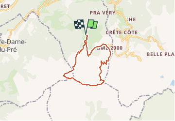

Length
12.4 km

Max alt
2567 m

Uphill gradient
839 m
Km-Effort
24 km

Min alt
1920 m

Downhill gradient
844 m
Boucle
Yes
Creation date :
2020-08-14 07:35:48.846
Updated on :
2020-08-15 07:15:21.163
4h05
Difficulty : Very easy

FREE GPS app for hiking
 SityTrail
IGN / Geographical institutes
SityTrail Plus
The world is yours!
About
Trail Walking of 12.4 km to be discovered at Auvergne-Rhône-Alpes, Savoy, Aime-la-Plagne. This trail is proposed by cmike39.
Positioning
Country:
France
Region :
Auvergne-Rhône-Alpes
Department/Province :
Savoy
Municipality :
Aime-la-Plagne
Location:
Aime
Start:(Dec)
Start:(UTM)
316467 ; 5043028 (32T) N.
Comments