Trail Walking Saint-Pierre-la-Bourlhonne - St_Pierre_Peyre_Mayou - Photo
 jagarnier
jagarnier

User GUIDE

© OpenStreetMap contributors
Length
Length
15 km
Max alt
Max alt
1539 m
Uphill gradient
Uphill gradient
646 m
Km-Effort
Km-Effort  
24 km
Min alt
Min alt
960 m
Downhill gradient
Downhill gradient
644 m
Boucle
Boucle
Yes
Creation date :
2020-08-17 08:51:24.398
Updated on :
2022-01-02 08:14:36.096

(0 Reviews)

Walking
Walking
4h45
Difficulty : Difficult

Scan this QR Code to open this trail in the SityTrail application

FREE GPS app for hiking

Logo SityTrail SityTrail

IGN / Geographical institutes

Download SityTrail from the App Store Download SityTrail from Google Play

Logo SityTrail SityTrail World

The world is yours!

Download SityTrail from the App Store Download SityTrail from Google Play Download SityTrail on Huawei AppGallery

About

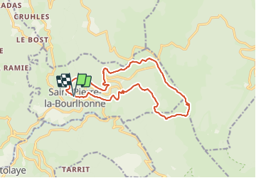
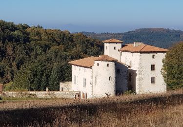
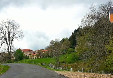
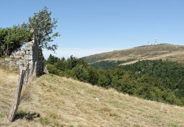
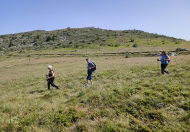
Trail Walking of 15 km to be discovered at Auvergne-Rhône-Alpes, Puy-de-Dôme, Saint-Pierre-la-Bourlhonne. This trail is proposed by jagarnier.

Description

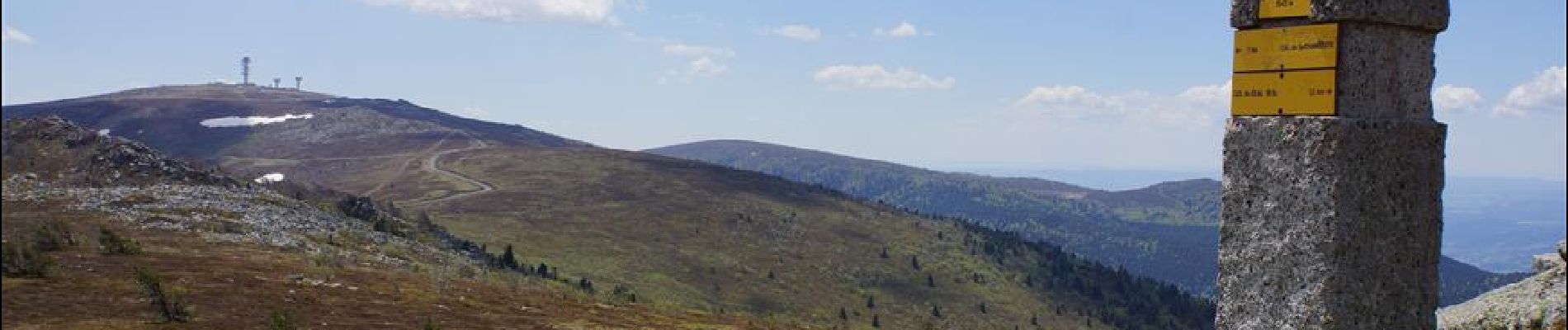
Le sentier forestier du départ se découvre pour arriver sur les Hautes-Chaumes, au col du Béal, puis à Peyre-Mayou. De là-haut, vous contemplerez les alignements des divers massifs composant le Puy-de-Dôme et la Loire.

Elevation profile

Photos

Positioning

Country:
France
Region :
Auvergne-Rhône-Alpes
Department/Province :
Puy-de-Dôme
Municipality :
Saint-Pierre-la-Bourlhonne
Location:
Unknown
Start:(UTM)
557814 ; 5058179 (31T) N.

Trails nearby

Trail On foot Marat - Saint-James - Photo
On foot
PRO

On foot

Easy
Marat, Auvergne-Rhône-Alpes, Puy-de-Dôme, France
3.3 km | 5.5 km-effort
1h 14min
Yes
Trail On foot Saint-Pierre-la-Bourlhonne - Peyre-Mayou - Photo
On foot
PRO

On foot

Medium
Saint-Pierre-la-Bourlhonne, Auvergne-Rhône-Alpes, Puy-de-Dôme, France
14.5 km | 23 km-effort
5h 7min
Yes
Trail On foot Job - La Vallee du Fossat - Les Rocher de la Pause - Photo
On foot
PRO

On foot

Easy
Job, Auvergne-Rhône-Alpes, Puy-de-Dôme, France
5.6 km | 9.7 km-effort
2h 11min
Yes
Trail Walking Marat - Ruisseau Vertolaye - Photo
Walking
antoine63480

Walking

Medium
(1)
Marat, Auvergne-Rhône-Alpes, Puy-de-Dôme, France
6.1 km | 9.2 km-effort
3h 0min
No
Trail Walking Job - Job_Pierre_Haute - Photo
Walking
GUIDE
jagarnier

Walking

Difficult
Job, Auvergne-Rhône-Alpes, Puy-de-Dôme, France
15.9 km | 24 km-effort
4h 45min
Yes
Trail Walking Saint-Pierre-la-Bourlhonne - tour de pierre sur haute - Photo
Walking
antoine63480

Walking

Very easy
(1)
Saint-Pierre-la-Bourlhonne, Auvergne-Rhône-Alpes, Puy-de-Dôme, France
11.2 km | 18.6 km-effort
3h 48min
No
Trail Walking Le Brugeron - 4ieme jour col du beal - Photo
Walking
jpdroux

Walking

Very difficult
Le Brugeron, Auvergne-Rhône-Alpes, Puy-de-Dôme, France
22 km | 33 km-effort
5h 55min
No
Trail Walking Job - Col de Beal - Photo
Walking
jpdroux

Walking

Very difficult
Job, Auvergne-Rhône-Alpes, Puy-de-Dôme, France
16.2 km | 23 km-effort
6h 12min
No
Trail Walking Saint-Pierre-la-Bourlhonne - 220621-StJean.Vêtre - Col Béal - Photo
Walking
randodan

Walking

Difficult
Saint-Pierre-la-Bourlhonne, Auvergne-Rhône-Alpes, Puy-de-Dôme, France
6.7 km | 10.6 km-effort
2h 47min
Yes


Close
My subscriptions