


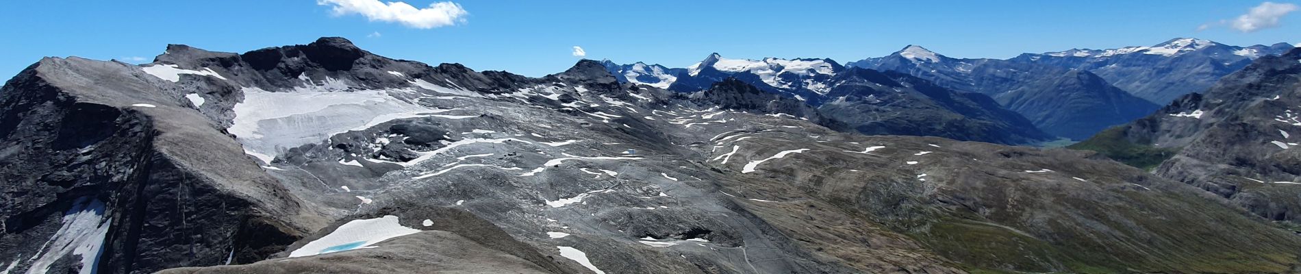
signal de l'Iseran

amiral13
User GUIDE
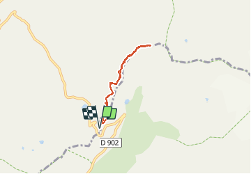

Length
5.2 km

Max alt
3212 m

Uphill gradient
488 m
Km-Effort
11.7 km

Min alt
2764 m

Downhill gradient
487 m
Boucle
Yes
Creation date :
2020-08-20 07:42:58.169
Updated on :
2020-08-20 17:16:26.535
3h09
Difficulty : Very difficult

FREE GPS app for hiking
 SityTrail
IGN / Geographical institutes
SityTrail Plus
The world is yours!
About
Trail Walking of 5.2 km to be discovered at Auvergne-Rhône-Alpes, Savoy, Bonneval-sur-Arc. This trail is proposed by amiral13.
Description
attention il s'agit d'une randonnée en terrain haute montagne. Ne vous y aventurez pas si vous n'avez pas le pied montagnard.
Photos


Positioning
Country:
France
Region :
Auvergne-Rhône-Alpes
Department/Province :
Savoy
Municipality :
Bonneval-sur-Arc
Location:
Unknown
Start:(Dec)
Start:(UTM)
345976 ; 5031317 (32T) N.
Comments