Trail Running Toulouse - les 15 du Manel - Photo
© OpenStreetMap contributors
Length
Length
15.2 km
Max alt
Max alt
267 m
Uphill gradient
Uphill gradient
377 m
Km-Effort
Km-Effort  
20 km
Min alt
Min alt
148 m
Downhill gradient
Downhill gradient
376 m
Boucle
Boucle
Yes
Creation date :
2014-12-10 00:00:00.0
Updated on :
2014-12-10 00:00:00.0

(1 Reviews)

Running
Running
1h44
Difficulty : Medium

Scan this QR Code to open this trail in the SityTrail application

FREE GPS app for hiking

Logo SityTrail SityTrail

IGN / Geographical institutes

Download SityTrail from the App Store Download SityTrail from Google Play

Logo SityTrail SityTrail World

The world is yours!

Download SityTrail from the App Store Download SityTrail from Google Play Download SityTrail on Huawei AppGallery

About

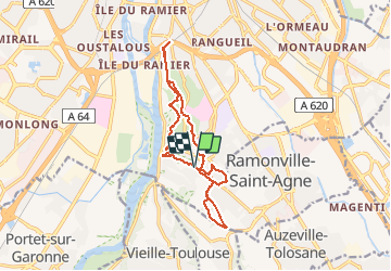
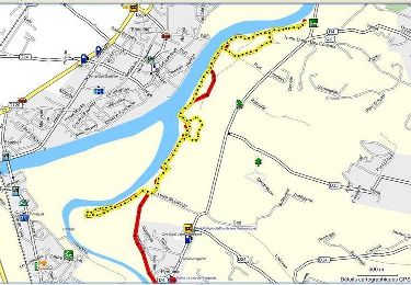
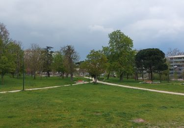
Trail Running of 15.2 km to be discovered at Occitania, Haute-Garonne, Toulouse. This trail is proposed by clementvictor.

Description

Boucle des abeilles, puis oppidum, Pech David et Pouvourville. Du dénivelé.

Elevation profile

Positioning

Country:
France
Region :
Occitania
Department/Province :
Haute-Garonne
Municipality :
Toulouse
Location:
Unknown
Start:(UTM)
374863 ; 4822708 (31T) N.

Comments

Please log in to post a review or rate the element


Trails nearby

Trail Walking Pinsaguel - PINSAGUEL : sentier de la Confluence (24.08.2023) - Photo
Walking
chrisgps

Walking

Very easy
Pinsaguel, Occitania, Haute-Garonne, France
3.8 km | 4.4 km-effort
1h 15min
Yes
Trail Walking Castanet-Tolosan - casranzt fait - Photo
Walking
pidjam

Walking

Very easy
(1)
Castanet-Tolosan, Occitania, Haute-Garonne, France
10.5 km | 12.6 km-effort
2h 26min
Yes
Trail Walking Lacroix-Falgarde - Promenade dominicale autour de Lacroix Falgarde - Photo
Walking
tracegps

Walking

Easy
Lacroix-Falgarde, Occitania, Haute-Garonne, France
8.6 km | 9.8 km-effort
2h 15min
Yes
Trail Walking Castanet-Tolosan - Boucle de Savignol  -  Castanet-Tolosan - Photo
Walking
tracegps

Walking

Medium
Castanet-Tolosan, Occitania, Haute-Garonne, France
10 km | 12.2 km-effort
2h 30min
Yes
Trail Walking Lacroix-Falgarde - Ariège Garonne variante - Lacroix Falgarde - Photo
Walking
tracegps

Walking

Easy
Lacroix-Falgarde, Occitania, Haute-Garonne, France
8.3 km | 9.6 km-effort
2h 30min
Yes
Trail Walking Pechbusque - De Pechbusque à Auzeville Tolosane - Photo
Walking
tracegps

Walking

Medium
Pechbusque, Occitania, Haute-Garonne, France
11.2 km | 14.2 km-effort
3h 30min
Yes
Trail Walking Pinsaguel - pinsaguel - Photo
Walking
rob66

Walking

Difficult
Pinsaguel, Occitania, Haute-Garonne, France
16.3 km | 18.1 km-effort
3h 27min
Yes
Trail Walking Toulouse - TT22 Bellefontaine variante - Photo
Walking

Walking

Medium
Toulouse, Occitania, Haute-Garonne, France
11 km | 12.3 km-effort
2h 0min
No
Trail Walking Toulouse - SityTrail - TT22 - Toulouse - Saouzelong - simple - Photo
Walking

Walking

Easy
Toulouse, Occitania, Haute-Garonne, France
5.8 km | 6.3 km-effort
1h 30min
No


Close
My subscriptions