


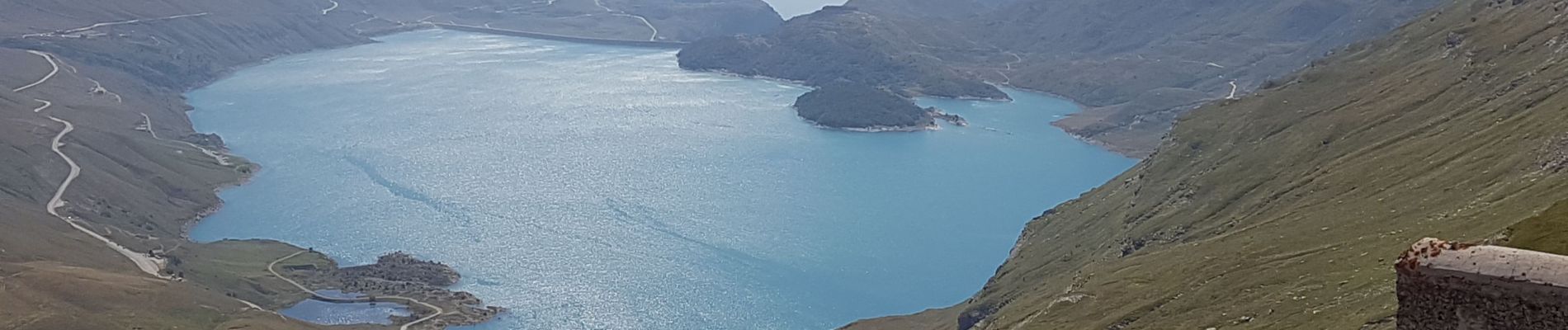
73 - Col du Mont-Cenis - Fort de la Tuera.

AndreLACOMBE
User

Length
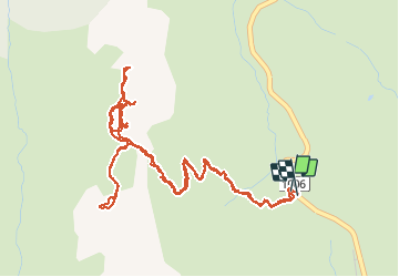
7.1 km

Max alt
2500 m

Uphill gradient
467 m
Km-Effort
13.3 km

Min alt
2085 m

Downhill gradient
469 m
Boucle
Yes
Creation date :
2020-08-25 07:39:17.424
Updated on :
2020-08-25 13:49:41.582
5h21
Difficulty : Medium

FREE GPS app for hiking
 SityTrail
IGN / Geographical institutes
SityTrail Plus
The world is yours!
About
Trail Walking of 7.1 km to be discovered at Auvergne-Rhône-Alpes, Savoy, Val-Cenis. This trail is proposed by AndreLACOMBE.
Description
Départ depuis le col (parking). Deux passages délicats équipés de câble.
Photos


Positioning
Country:
France
Region :
Auvergne-Rhône-Alpes
Department/Province :
Savoy
Municipality :
Val-Cenis
Location:
Unknown
Start:(Dec)
Start:(UTM)
335260 ; 5013992 (32T) N.
Comments