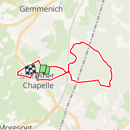


9.6 km | 12.1 km-effort


Randonnées de la Maison du Tourisme du Pays de Herve GUIDE+


FREE GPS app for hiking
 SityTrail
IGN / Geographical institutes
SityTrail World
The world is yours!
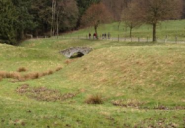
Trail Walking of 6.9 km to be discovered at Wallonia, Liège, Plombières. This trail is proposed by Maison du Tourisme du pays de Herve.
Itinéraire forestier et dans le site marial de Moresnet Chapelle.

Walking


Walking
Walking

Walking
Walking

Walking

Walking