


Querben Hilsenfirst

vaillantjm
User
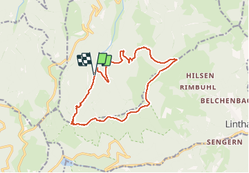

Length
15.1 km

Max alt
1320 m

Uphill gradient
738 m
Km-Effort
25 km

Min alt
739 m

Downhill gradient
744 m
Boucle
Yes
Creation date :
2020-09-04 07:53:50.018
Updated on :
2020-09-05 12:05:45.826
5h00
Difficulty : Difficult

FREE GPS app for hiking
 SityTrail
IGN / Geographical institutes
SityTrail Plus
The world is yours!
About
Trail Walking of 15.1 km to be discovered at Grand Est, Haut-Rhin, Sondernach. This trail is proposed by vaillantjm.
Description
Belle montée jusqu'au col d'Oberlauchen. Quelques belles échappées sur les vallées environnantes et les Alpes Bernoises, si le temps s'y prête.
Positioning
Country:
France
Region :
Grand Est
Department/Province :
Haut-Rhin
Municipality :
Sondernach
Location:
Unknown
Start:(Dec)
Start:(UTM)
354965 ; 5314169 (32T) N.
Comments