Trail Walking Les Ferres - Les Ferres Conségudes et rive droite Esteron - Photo

Les Ferres Conségudes et rive droite Esteron

 GrouGary
GrouGary

User

© OpenStreetMap contributors
Length
Length
13.4 km
Max alt
Max alt
712 m
Uphill gradient
Uphill gradient
701 m
Km-Effort
Km-Effort  
23 km
Min alt
Min alt
259 m
Downhill gradient
Downhill gradient
707 m
Boucle
Boucle
Yes
Creation date :
2020-09-06 06:13:44.467
Updated on :
2020-09-20 17:59:53.278

(0 Reviews)

Walking
Walking
8h50
Difficulty : Medium

Scan this QR Code to open this trail in the SityTrail application

FREE GPS app for hiking

Logo SityTrail SityTrail

IGN / Geographical institutes

Download SityTrail from the App Store Download SityTrail from Google Play

Logo SityTrail SityTrail World

The world is yours!

Download SityTrail from the App Store Download SityTrail from Google Play Download SityTrail on Huawei AppGallery

About

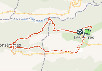
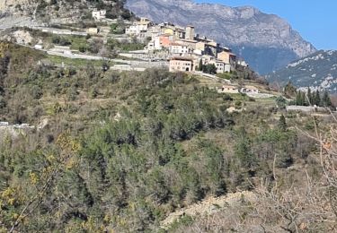
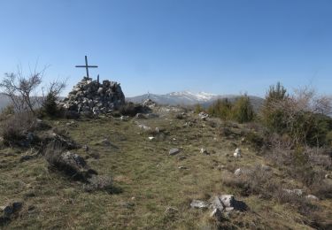
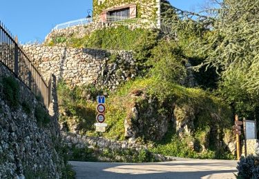
Trail Walking of 13.4 km to be discovered at Provence-Alpes-Côte d'Azur, Maritime Alps, Les Ferres. This trail is proposed by GrouGary.

Description

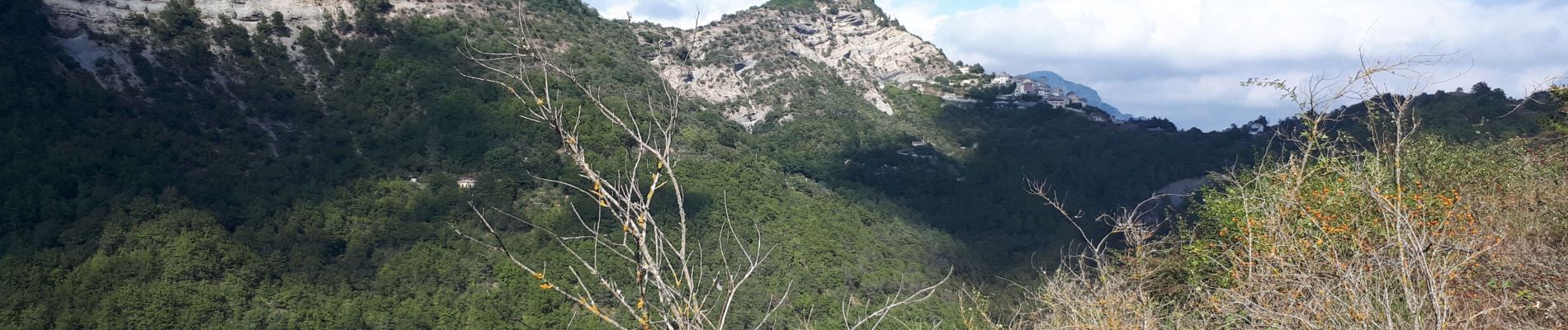
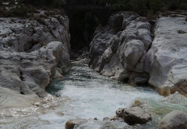
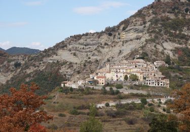
Circuit ombragé en ubac à la montée.  Idem après Conségudes et le magnifique chêne de Pascaline. Un beau circuit dans les gorges sauvages de l'Esteron.

Elevation profile

Photos

Positioning

Country:
France
Region :
Provence-Alpes-Côte d'Azur
Department/Province :
Maritime Alps
Municipality :
Les Ferres
Location:
Unknown
Start:(UTM)
346738 ; 4856601 (32T) N.

Trails nearby

Trail On foot Bouyon - track - Photo
On foot
domi06

On foot

Medium
(1)
Bouyon, Provence-Alpes-Côte d'Azur, Maritime Alps, France
16 km | 29 km-effort
6h 0min
Yes
Trail On foot Bouyon - Gorges de l'Estéron - Photo
On foot
PRO

On foot

Medium
Bouyon, Provence-Alpes-Côte d'Azur, Maritime Alps, France
12 km | 22 km-effort
5h 3min
Yes
Trail Walking Revest-les-Roches - Balme de Vial - Photo
Walking
56jj

Walking

Medium
Revest-les-Roches, Provence-Alpes-Côte d'Azur, Maritime Alps, France
7.4 km | 14.6 km-effort
5h 1min
No
Trail Walking Les Ferres - les ferres consegudes  - Photo
Walking
Mariephil

Walking

Very difficult
Les Ferres, Provence-Alpes-Côte d'Azur, Maritime Alps, France
11.8 km | 19.6 km-effort
4h 45min
Yes
Trail Walking Bézaudun-les-Alpes - Mont Estellier au départ de Bézaudun - Photo
Walking
aris

Walking

Medium
Bézaudun-les-Alpes, Provence-Alpes-Côte d'Azur, Maritime Alps, France
13.4 km | 21 km-effort
5h 40min
Yes
Trail Walking Les Ferres - cime de l estellier des ferres - Photo
Walking
Rosalie06

Walking

Very easy
(1)
Les Ferres, Provence-Alpes-Côte d'Azur, Maritime Alps, France
14.4 km | 25 km-effort
8h 5min
Yes
Trail Walking Gilette - gorges de l'esteron - Photo
Walking
jh-caillotte

Walking

Medium
(1)
Gilette, Provence-Alpes-Côte d'Azur, Maritime Alps, France
2.1 km | 2.8 km-effort
30min
No
Trail Mountain bike Les Ferres - Grande Traversée des PréAlpes à VTT : La Vallière - Carros le Neuf - Photo
Mountain bike
tracegps

Mountain bike

Difficult
Les Ferres, Provence-Alpes-Côte d'Azur, Maritime Alps, France
20 km | 28 km-effort
4h 0min
No
Trail Walking Bézaudun-les-Alpes -  Bezaudun : Mont Estellier - Photo
Walking
ETMU5496

Walking

Very difficult
Bézaudun-les-Alpes, Provence-Alpes-Côte d'Azur, Maritime Alps, France
15.8 km | 27 km-effort
6h 3min
Yes


Close
My subscriptions