Trail Walking Vallouise-Pelvoux - 2020-09-10 Marche Vallouise Refuge des bans - Photo

2020-09-10 Marche Vallouise Refuge des bans

 holtzv
holtzv

User GUIDE

© OpenStreetMap contributors
Length
Length
10.2 km
Max alt
Max alt
2333 m
Uphill gradient
Uphill gradient
724 m
Km-Effort
Km-Effort  
19.8 km
Min alt
Min alt
1612 m
Downhill gradient
Downhill gradient
723 m
Boucle
Boucle
Yes
Creation date :
2020-09-10 07:38:38.317
Updated on :
2020-09-21 16:57:07.93

(0 Reviews)

Walking
Walking
4h39
Difficulty : Very easy

Scan this QR Code to open this trail in the SityTrail application

FREE GPS app for hiking

Logo SityTrail SityTrail

IGN / Geographical institutes

Download SityTrail from the App Store Download SityTrail from Google Play

Logo SityTrail SityTrail World

The world is yours!

Download SityTrail from the App Store Download SityTrail from Google Play Download SityTrail on Huawei AppGallery

About

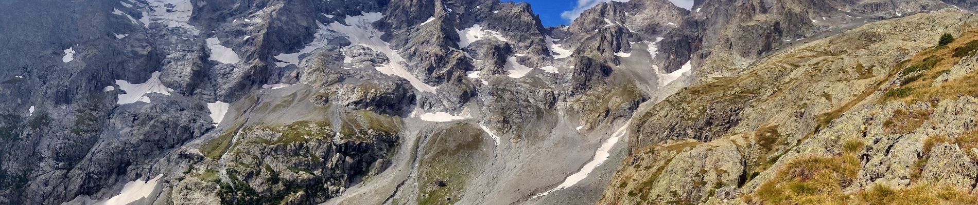
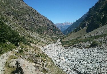
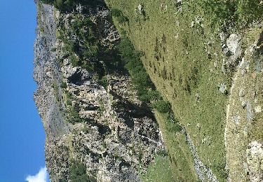
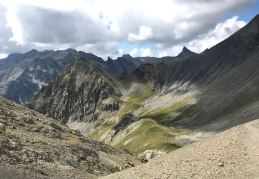
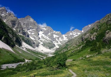
Trail Walking of 10.2 km to be discovered at Provence-Alpes-Côte d'Azur, Hautes-Alpes, Vallouise-Pelvoux. This trail is proposed by holtzv.

Description

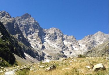
Ascension rapide vers le Refuge des Bans (alt 2083m). Un petit sentier à côté de ce dernier permet de monter plus haut vers le Peyre Arguet. On s’arrête après 300m de dénivelé pour admirer la vue sur les différents glaciers et pics des Bans. Repas au refuge.

Elevation profile

Photos

Positioning

Country:
France
Region :
Provence-Alpes-Côte d'Azur
Department/Province :
Hautes-Alpes
Municipality :
Vallouise-Pelvoux
Location:
Vallouise
Start:(UTM)
294725 ; 4967440 (32T) N.

Trails nearby

Trail Walking Vallouise-Pelvoux - refuge des bancs  - Photo
Walking
Philou888

Walking

Easy
(1)
Vallouise-Pelvoux, Provence-Alpes-Côte d'Azur, Hautes-Alpes, France
9.3 km | 16.1 km-effort
3h 4min
Yes
Trail Walking Vallouise-Pelvoux - vallon de la selle cabane du jas Lacroix  - Photo
Walking
Philou888

Walking

Easy
Vallouise-Pelvoux, Provence-Alpes-Côte d'Azur, Hautes-Alpes, France
9.7 km | 14.5 km-effort
3h 20min
Yes
Trail Walking Vallouise-Pelvoux - Tour des Écrins J4 - Photo
Walking
ploopakete

Walking

Very difficult
Vallouise-Pelvoux, Provence-Alpes-Côte d'Azur, Hautes-Alpes, France
23 km | 48 km-effort
7h 55min
No
Trail Walking Vallouise-Pelvoux - refuge des bans - Photo
Walking
desbois

Walking

Very easy
Vallouise-Pelvoux, Provence-Alpes-Côte d'Azur, Hautes-Alpes, France
8.7 km | 15.1 km-effort
4h 40min
Yes
Trail Walking Vallouise-Pelvoux - Entre les Aigues - Photo
Walking
Sigmut

Walking

Very easy
Vallouise-Pelvoux, Provence-Alpes-Côte d'Azur, Hautes-Alpes, France
1.4 km | 1.8 km-effort
52min
Yes
Trail Walking Vallouise-Pelvoux - Refuge des bans 29-07-18 - Photo
Walking
annefrance70

Walking

Medium
Vallouise-Pelvoux, Provence-Alpes-Côte d'Azur, Hautes-Alpes, France
8.4 km | 14.8 km-effort
2h 59min
Yes
Trail Walking Vallouise-Pelvoux - ECRIN Etape 4 Entreigues Pré de la Chaumette - Photo
Walking
yves12

Walking

Very difficult
Vallouise-Pelvoux, Provence-Alpes-Côte d'Azur, Hautes-Alpes, France
17 km | 32 km-effort
7h 52min
No
Trail Walking Vallouise-Pelvoux - refuge des bans - Photo
Walking
th.feur

Walking

Very easy
Vallouise-Pelvoux, Provence-Alpes-Côte d'Azur, Hautes-Alpes, France
12.9 km | 20 km-effort
4h 43min
Yes
Trail Walking Puy-Saint-Vincent - Narreyrou - Photo
Walking
Vinceneux

Walking

Difficult
Puy-Saint-Vincent, Provence-Alpes-Côte d'Azur, Hautes-Alpes, France
7.4 km | 13.2 km-effort
3h 48min
Yes


Close
My subscriptions