Vallouise-Pelvoux, Hautes-Alpes: Best trails, routes and walks

17 comments

Vallouise-Pelvoux: Discover the best trails: 271 hiking trails and 9 bike and mountain-bike routes. All these trails, routes and outdoor activities are available in our SityTrail applications for smartphones and tablets.
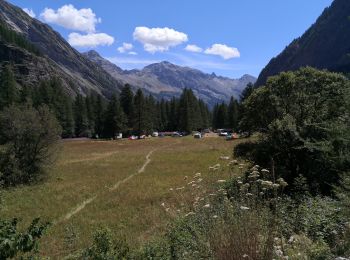
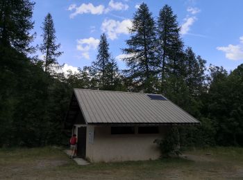
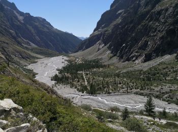

The best trails (304)

Trail Walking Vallouise-Pelvoux - 2020-09-09 Marche Lac de L'Eychauda - Photo
Walking 14.486
Km
GUIDE

Walking

Easy
(1)
Vallouise-Pelvoux, Provence-Alpes-Côte d'Azur, Hautes-Alpes, France
14.5 km | 28 km-effort
6h 2min
977 m
979 m
Yes
holtzv

Trail Walking Vallouise-Pelvoux - traversé du pelvoux - Photo
Walking 24.671
Km

Walking

Very easy
(2)
Vallouise-Pelvoux, Provence-Alpes-Côte d'Azur, Hautes-Alpes, France
25 km | 58 km-effort
19h 10min
2476 m
2486 m
No
bellouelo46

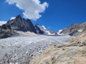
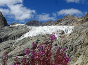
• marche sur neige et glacier

Trail Walking Vallouise-Pelvoux - refuge des bancs  - Photo
Walking 9.326
Km

Walking

Easy
(1)
Vallouise-Pelvoux, Provence-Alpes-Côte d'Azur, Hautes-Alpes, France
9.3 km | 16.1 km-effort
3h 4min
506 m
505 m
Yes
Philou888

Trail Walking Vallouise-Pelvoux - le refuge glacier blanc et le point de vue sur la barre - Photo
Walking 14.095
Km
GUIDE

Walking

Very difficult
Vallouise-Pelvoux, Provence-Alpes-Côte d'Azur, Hautes-Alpes, France
14.1 km | 29 km-effort
7h 51min
1146 m
1146 m
Yes
amiral13

Trail Walking Vallouise-Pelvoux - lac de l'Eychauda col des Grangettes pas de l'âne et col de l'Eychauda - Photo
Walking 15.83
Km
GUIDE

Walking

Difficult
Vallouise-Pelvoux, Provence-Alpes-Côte d'Azur, Hautes-Alpes, France
15.8 km | 31 km-effort
7h 46min
1168 m
1170 m
Yes
amiral13

Trail On foot Vallouise-Pelvoux - Boucle vers Puy Aillaud - Photo
On foot 5.273
Km
PRO

On foot

Easy
Vallouise-Pelvoux, Provence-Alpes-Côte d'Azur, Hautes-Alpes, France
5.3 km | 10.2 km-effort
2h 19min
358 m
404 m
No
SityTrail - itinéraires balisés pédestres

• Trail created by Communauté de communes du Pays des Ecrins.

Trail On foot Vallouise-Pelvoux - Boucle de Pelvoux - Photo
On foot 12.217
Km
PRO

On foot

Easy
Vallouise-Pelvoux, Provence-Alpes-Côte d'Azur, Hautes-Alpes, France
12.2 km | 18.7 km-effort
4h 15min
488 m
491 m
Yes
SityTrail - itinéraires balisés pédestres

• Trail created by Communauté de communes du Pays des Ecrins.

Trail On foot Vallouise-Pelvoux - Boucle de Vallouise - Photo
On foot 8.09
Km
PRO

On foot

Easy
Vallouise-Pelvoux, Provence-Alpes-Côte d'Azur, Hautes-Alpes, France
8.1 km | 11.6 km-effort
2h 38min
270 m
257 m
Yes
SityTrail - itinéraires balisés pédestres

• Trail created by Communauté de communes du Pays des Ecrins.

Trail Walking Vallouise-Pelvoux - 2020-09-07 Marche Ailefroide Glaciers Blanc et Noir - Photo
Walking 14.031
Km
GUIDE

Walking

Easy
Vallouise-Pelvoux, Provence-Alpes-Côte d'Azur, Hautes-Alpes, France
14 km | 29 km-effort
4h 36min
1105 m
1106 m
Yes
holtzv

Trail Walking Vallouise-Pelvoux - Lac de Puy Aillaud - Photo
Walking 11.528
Km
GUIDE

Walking

Very difficult
Vallouise-Pelvoux, Provence-Alpes-Côte d'Azur, Hautes-Alpes, France
11.5 km | 25 km-effort
5h 1min
983 m
975 m
Yes
R@ph

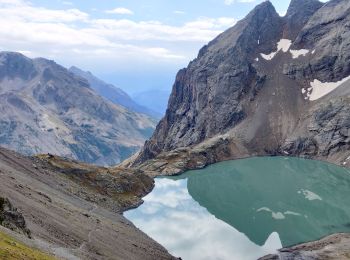
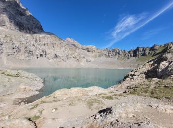
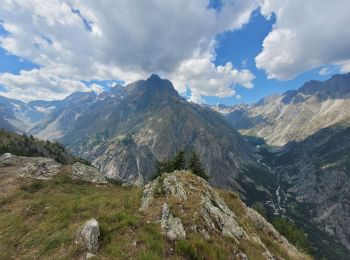
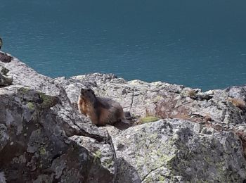
• Belle randonnée en boucle vers le Lac de Puy Aillaud au départ de la station de Pelvoux. Passage par le belvédère des...

Trail Walking Vallouise-Pelvoux - Lac Eychauda - Photo
Walking 8.429
Km

Walking

Medium
(1)
Vallouise-Pelvoux, Provence-Alpes-Côte d'Azur, Hautes-Alpes, France
8.4 km | 18.6 km-effort
3h 10min
766 m
768 m
Yes
MarcLEBARON

Trail sport Vallouise-Pelvoux - l’ondinette  - Photo
sport 5.36
Km

sport

Very easy
Vallouise-Pelvoux, Provence-Alpes-Côte d'Azur, Hautes-Alpes, France
5.4 km | 6.8 km-effort
Unknown
105 m
108 m
Yes
babouille

Trail Walking Vallouise-Pelvoux - Lac de l'Eychauda en boucle - Photo
Walking 15.792
Km

Walking

Very difficult
Vallouise-Pelvoux, Provence-Alpes-Côte d'Azur, Hautes-Alpes, France
15.8 km | 31 km-effort
5h 47min
1172 m
1173 m
Yes
GuyVachet

Trail Walking Vallouise-Pelvoux - la blanche et le belvédère des trois refuges - Photo
Walking 14.162
Km
GUIDE

Walking

Medium
Vallouise-Pelvoux, Provence-Alpes-Côte d'Azur, Hautes-Alpes, France
14.2 km | 33 km-effort
8h 47min
1416 m
1416 m
Yes
amiral13

Trail Walking Vallouise-Pelvoux - Lac Eychauda et le  col des Grangettes - Photo
Walking 13.194
Km

Walking

Medium
Vallouise-Pelvoux, Provence-Alpes-Côte d'Azur, Hautes-Alpes, France
13.2 km | 26 km-effort
3h 20min
970 m
967 m
Yes
Forain

Trail Walking Vallouise-Pelvoux - 05-pre-Mme-Carle-glacier-noir-8km-600m-aout21 - Photo
Walking 8.418
Km

Walking

Medium
Vallouise-Pelvoux, Provence-Alpes-Côte d'Azur, Hautes-Alpes, France
8.4 km | 16.3 km-effort
4h 8min
595 m
585 m
Yes
SyMA

Trail Walking Vallouise-Pelvoux - 2020-09-10 Marche Vallouise Refuge des bans - Photo
Walking 10.199
Km
GUIDE

Walking

Very easy
Vallouise-Pelvoux, Provence-Alpes-Côte d'Azur, Hautes-Alpes, France
10.2 km | 19.8 km-effort
4h 39min
724 m
723 m
Yes
holtzv

Trail Walking Vallouise-Pelvoux - Source Puiseux - Photo
Walking 9.02
Km

Walking

Medium
Vallouise-Pelvoux, Provence-Alpes-Côte d'Azur, Hautes-Alpes, France
9 km | 15.3 km-effort
4h 17min
469 m
477 m
Yes
Sigmut

Trail Walking Vallouise-Pelvoux - Cascade de la Pisse et pont des places - Photo
Walking 6.615
Km

Walking

Very easy
Vallouise-Pelvoux, Provence-Alpes-Côte d'Azur, Hautes-Alpes, France
6.6 km | 8.5 km-effort
2h 56min
140 m
141 m
Yes
Sigmut

Trail Walking Vallouise-Pelvoux - Le Glacier Blanc - Pré Madame Carle - Photo
Walking 6.556
Km

Walking

Medium
Vallouise-Pelvoux, Provence-Alpes-Côte d'Azur, Hautes-Alpes, France
6.6 km | 12.2 km-effort
4h 23min
422 m
423 m
Yes
Sigmut

20 trails displayed on 304

FREE GPS app for hiking

Logo SityTrail SityTrail

IGN / Geographical institutes

Download SityTrail from the App Store Download SityTrail from Google Play

Logo SityTrail SityTrail World

The world is yours!

Download SityTrail from the App Store Download SityTrail from Google Play Download SityTrail on Huawei AppGallery

Activities

Nearby regions

Close
My subscriptions