


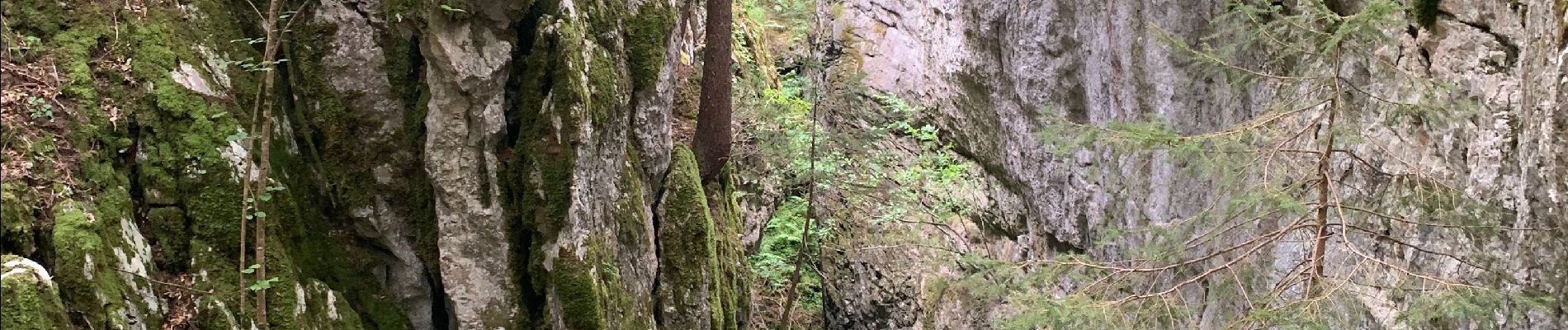
La glacière par le pas des chèvres

pconte
User

Length
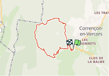
8.5 km

Max alt
1341 m

Uphill gradient
260 m
Km-Effort
12 km

Min alt
1144 m

Downhill gradient
262 m
Boucle
Yes
Creation date :
2020-09-10 12:16:00.0
Updated on :
2020-09-10 16:05:09.688
2h25
Difficulty : Unknown

FREE GPS app for hiking
 SityTrail
IGN / Geographical institutes
SityTrail Plus
The world is yours!
About
Trail Walking of 8.5 km to be discovered at Auvergne-Rhône-Alpes, Isère, Corrençon-en-Vercors. This trail is proposed by pconte.
Photos

Positioning
Country:
France
Region :
Auvergne-Rhône-Alpes
Department/Province :
Isère
Municipality :
Corrençon-en-Vercors
Location:
Unknown
Start:(Dec)
Start:(UTM)
698316 ; 4988747 (31T) N.
Comments