


Refuge Prariond BS

bstebe
User
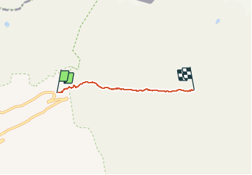

Length
3.1 km

Max alt
2324 m

Uphill gradient
278 m
Km-Effort
5.9 km

Min alt
2062 m

Downhill gradient
23 m
Boucle
No
Creation date :
2020-09-11 07:33:00.831
Updated on :
2020-09-11 08:56:08.542
1h11
Difficulty : Very easy

FREE GPS app for hiking
 SityTrail
IGN / Geographical institutes
SityTrail Plus
The world is yours!
About
Trail Walking of 3.1 km to be discovered at Auvergne-Rhône-Alpes, Savoy, Val-d'Isère. This trail is proposed by bstebe.
Positioning
Country:
France
Region :
Auvergne-Rhône-Alpes
Department/Province :
Savoy
Municipality :
Val-d'Isère
Location:
Unknown
Start:(Dec)
Start:(UTM)
346550 ; 5035374 (32T) N.
Comments