


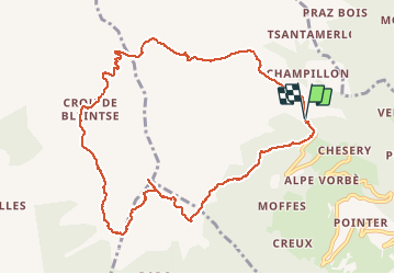
Mont Saron-col Champillon Italie 11/09/2020

Alainconnu
User

Length
11.5 km

Max alt
2713 m

Uphill gradient
1070 m
Km-Effort
26 km

Min alt
2067 m

Downhill gradient
1071 m
Boucle
Yes
Creation date :
2020-09-11 07:41:39.313
Updated on :
2020-09-11 15:23:34.213
3h48
Difficulty : Difficult

FREE GPS app for hiking
 SityTrail
IGN / Geographical institutes
SityTrail Plus
The world is yours!
About
Trail Walking of 11.5 km to be discovered at Aosta Valley, Unknown, Doues. This trail is proposed by Alainconnu.
Positioning
Country:
Italy
Region :
Aosta Valley
Department/Province :
Unknown
Municipality :
Doues
Location:
Unknown
Start:(Dec)
Start:(UTM)
367046 ; 5078025 (32T) N.
Comments