Trail Walking Nans-sous-Sainte-Anne - ruines du château sainte anne - Photo
© OpenStreetMap contributors
Length
Length
11.1 km
Max alt
Max alt
694 m
Uphill gradient
Uphill gradient
609 m
Km-Effort
Km-Effort  
19.2 km
Min alt
Min alt
367 m
Downhill gradient
Downhill gradient
608 m
Boucle
Boucle
Yes
Creation date :
2020-09-14 07:58:14.673
Updated on :
2020-10-09 17:20:30.313

(1 Reviews)

Walking
Walking
4h14
Difficulty : Medium

Scan this QR Code to open this trail in the SityTrail application

FREE GPS app for hiking

Logo SityTrail SityTrail

IGN / Geographical institutes

Download SityTrail from the App Store Download SityTrail from Google Play

Logo SityTrail SityTrail World

The world is yours!

Download SityTrail from the App Store Download SityTrail from Google Play Download SityTrail on Huawei AppGallery

About

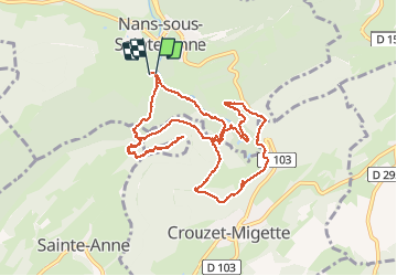
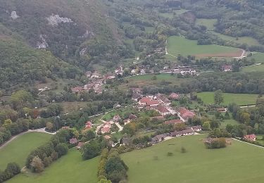
Trail Walking of 11.1 km to be discovered at Bourgogne-Franche-Comté, Doubs, Nans-sous-Sainte-Anne. This trail is proposed by eltonnermou.

Description

randonnée en groupe
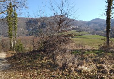
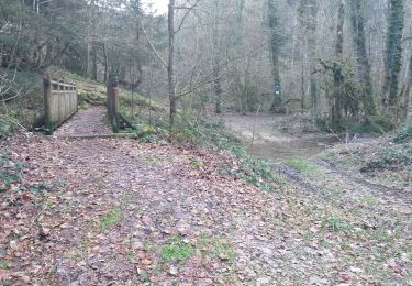
au départ de la taillenderie (parking sur la gauche avant la taillenderie).
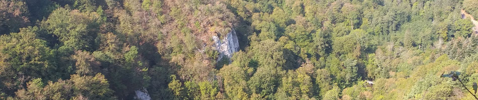
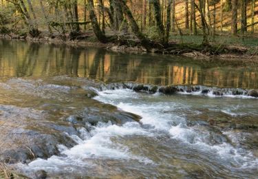
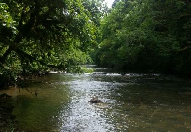
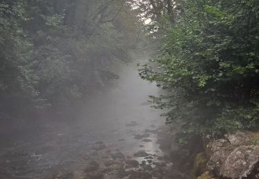
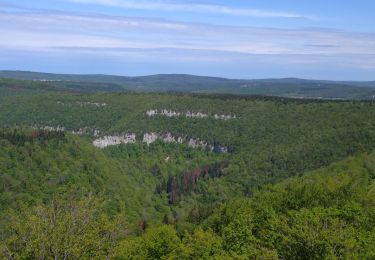
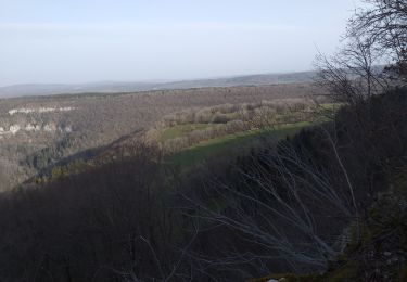
ce joli parcours vous mènera en suivant les berges du Lison, à la grotte Sarrazine,  les sources du Lison, le Creux Billard (pas sur le tracé, un allé et retour qui vaut la peine), Migette et aux ruines du château ste-Anne. Pour la descente (très engageante) de retour, les bâtons sont conseillés. Tout au long du parcours laissez vous surprendre par la flore et parfois des chamois et autres écureuils. De jolis points de vue vous régaleront les yeux.
le conseil : faite cette randonnée dans l'autre sens ; la montée sera un peu rude (mais dans le cas contraire ce srait la descente qui vous fera mal aux genous) mais le reste du parcours vous régalera, car face à vous et vos yeux.

Elevation profile

Photos

Positioning

Country:
France
Region :
Bourgogne-Franche-Comté
Department/Province :
Doubs
Municipality :
Nans-sous-Sainte-Anne
Location:
Unknown
Start:(UTM)
728043 ; 5206488 (31T) N.

Comments

Please log in to post a review or rate the element


Oublié de mentionner la vipère 😱


Trails nearby

Trail Walking Éternoz - Eternoz,  lison  - Photo
Walking
eltonnermou

Walking

Easy
(1)
Éternoz, Bourgogne-Franche-Comté, Doubs, France
15 km | 19.2 km-effort
2h 13min
Yes
Trail Walking Éternoz - Les Gorges du Lison - Eternoz - Photo
Walking
tracegps

Walking

Medium
(2)
Éternoz, Bourgogne-Franche-Comté, Doubs, France
10.9 km | 14.4 km-effort
3h 0min
Yes
Trail Walking Éternoz - eternoz belvédère chandelier - Photo
Walking
mormal

Walking

Medium
(2)
Éternoz, Bourgogne-Franche-Comté, Doubs, France
15.9 km | 20 km-effort
5h 13min
Yes
Trail Walking Nans-sous-Sainte-Anne - Boucle du Lison - Photo
Walking
mallovon

Walking

Medium
Nans-sous-Sainte-Anne, Bourgogne-Franche-Comté, Doubs, France
6.2 km | 10.1 km-effort
2h 10min
Yes
Trail Walking Nans-sous-Sainte-Anne - Nans sous st Anne
Walking
eltonnermou

Walking

Difficult
(1)
Nans-sous-Sainte-Anne, Bourgogne-Franche-Comté, Doubs, France
16.1 km | 25 km-effort
2h 59min
Yes
Trail Walking Éternoz - Nans sous ste Anne, Lizon - Photo
Walking
mpstoop

Walking

Very difficult
Éternoz, Bourgogne-Franche-Comté, Doubs, France
24 km | 37 km-effort
6h 54min
Yes
Trail Walking Éternoz - éternoz la re-belle - Photo
Walking
eltonnermou

Walking

Difficult
Éternoz, Bourgogne-Franche-Comté, Doubs, France
36 km | 49 km-effort
5h 46min
Yes
Trail Walking Nans-sous-Sainte-Anne - Nans st Anne, belvédères - Photo
Walking
eltonnermou

Walking

Difficult
Nans-sous-Sainte-Anne, Bourgogne-Franche-Comté, Doubs, France
11.8 km | 17.3 km-effort
1h 56min
Yes
Trail Walking Éternoz - Eternoz, Montmahoux - Photo
Walking
eltonnermou

Walking

Difficult
(1)
Éternoz, Bourgogne-Franche-Comté, Doubs, France
17.4 km | 25 km-effort
2h 38min
Yes


Close
My subscriptions