

Nans sous st Anne "pont du diable"

eltonnermou
User


2h59
Difficulty : Difficult

FREE GPS app for hiking
About
Trail Walking of 16.1 km to be discovered at Bourgogne-Franche-Comté, Doubs, Nans-sous-Sainte-Anne. This trail is proposed by eltonnermou.
Description
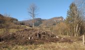
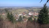
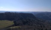
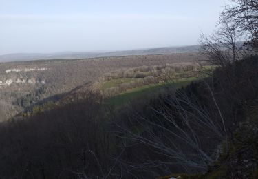
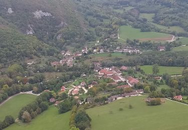
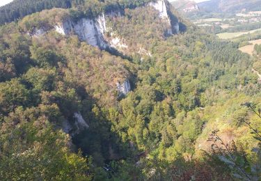
Cette très belle randonnée pédestre vous entrainera à travers différents paysages, jalonnée de nombreux beaux points de vues sur le village de Nans sous st Anne, sa vallée ; puis une fois sur le plateau les monts du Haut-Doubs et de la Suisse. La montée est très engageante (800m env), avec certains passages difficiles, les bâtons sont conseillés. Le pont du diable va vous surprendre par sa hauteur et la vue qu'il offre. A sa sortie prendre à gauche (comme la trace vous y invite) mais à l'entrée du champ prendre encore à gauche pour rejoindre un chemin (ne pas suivre la trace) et arriver à Crouzet-Migette par un chemin plus tranquille que la route.
La montée sur Montmahoux est rude mais la récompense vous attend au sommet, profitez en : plein les yeux.
Avec un peu de chance, vous rencontrerez de belles surprises : chamois sur les pentes escarpées du secteur, renard, écureuil. Vous pourrez apprécier la diversité de la flore.
Possibilité de faire ce parcours dans l'autre sens (la montée est toute aussi difficile).
Photos
 "
data-pinterest-text="Pin it"
data-tweet-text="share on twitter"
data-facebook-share-url="https://www.sitytrail.com/en/trails/3160547-nansxsousxsaintexanne--nans-sous-st-anne-xpont-du-diablex/?photo=1#lg=1&slide=1"
data-twitter-share-url="https://www.sitytrail.com/en/trails/3160547-nansxsousxsaintexanne--nans-sous-st-anne-xpont-du-diablex/?photo=1#lg=1&slide=1"
data-googleplus-share-url="https://www.sitytrail.com/en/trails/3160547-nansxsousxsaintexanne--nans-sous-st-anne-xpont-du-diablex/?photo=1#lg=1&slide=1"
data-pinterest-share-url="https://www.sitytrail.com/en/trails/3160547-nansxsousxsaintexanne--nans-sous-st-anne-xpont-du-diablex/?photo=1#lg=1&slide=1">
 "
data-pinterest-text="Pin it"
data-tweet-text="share on twitter"
data-facebook-share-url="https://www.sitytrail.com/en/trails/3160547-nansxsousxsaintexanne--nans-sous-st-anne-xpont-du-diablex/?photo=2#lg=1&slide=2"
data-twitter-share-url="https://www.sitytrail.com/en/trails/3160547-nansxsousxsaintexanne--nans-sous-st-anne-xpont-du-diablex/?photo=2#lg=1&slide=2"
data-googleplus-share-url="https://www.sitytrail.com/en/trails/3160547-nansxsousxsaintexanne--nans-sous-st-anne-xpont-du-diablex/?photo=2#lg=1&slide=2"
data-pinterest-share-url="https://www.sitytrail.com/en/trails/3160547-nansxsousxsaintexanne--nans-sous-st-anne-xpont-du-diablex/?photo=2#lg=1&slide=2">
 "
data-pinterest-text="Pin it"
data-tweet-text="share on twitter"
data-facebook-share-url="https://www.sitytrail.com/en/trails/3160547-nansxsousxsaintexanne--nans-sous-st-anne-xpont-du-diablex/?photo=3#lg=1&slide=3"
data-twitter-share-url="https://www.sitytrail.com/en/trails/3160547-nansxsousxsaintexanne--nans-sous-st-anne-xpont-du-diablex/?photo=3#lg=1&slide=3"
data-googleplus-share-url="https://www.sitytrail.com/en/trails/3160547-nansxsousxsaintexanne--nans-sous-st-anne-xpont-du-diablex/?photo=3#lg=1&slide=3"
data-pinterest-share-url="https://www.sitytrail.com/en/trails/3160547-nansxsousxsaintexanne--nans-sous-st-anne-xpont-du-diablex/?photo=3#lg=1&slide=3">
 "
data-pinterest-text="Pin it"
data-tweet-text="share on twitter"
data-facebook-share-url="https://www.sitytrail.com/en/trails/3160547-nansxsousxsaintexanne--nans-sous-st-anne-xpont-du-diablex/?photo=4#lg=1&slide=4"
data-twitter-share-url="https://www.sitytrail.com/en/trails/3160547-nansxsousxsaintexanne--nans-sous-st-anne-xpont-du-diablex/?photo=4#lg=1&slide=4"
data-googleplus-share-url="https://www.sitytrail.com/en/trails/3160547-nansxsousxsaintexanne--nans-sous-st-anne-xpont-du-diablex/?photo=4#lg=1&slide=4"
data-pinterest-share-url="https://www.sitytrail.com/en/trails/3160547-nansxsousxsaintexanne--nans-sous-st-anne-xpont-du-diablex/?photo=4#lg=1&slide=4">
 "
data-pinterest-text="Pin it"
data-tweet-text="share on twitter"
data-facebook-share-url="https://www.sitytrail.com/en/trails/3160547-nansxsousxsaintexanne--nans-sous-st-anne-xpont-du-diablex/?photo=5#lg=1&slide=5"
data-twitter-share-url="https://www.sitytrail.com/en/trails/3160547-nansxsousxsaintexanne--nans-sous-st-anne-xpont-du-diablex/?photo=5#lg=1&slide=5"
data-googleplus-share-url="https://www.sitytrail.com/en/trails/3160547-nansxsousxsaintexanne--nans-sous-st-anne-xpont-du-diablex/?photo=5#lg=1&slide=5"
data-pinterest-share-url="https://www.sitytrail.com/en/trails/3160547-nansxsousxsaintexanne--nans-sous-st-anne-xpont-du-diablex/?photo=5#lg=1&slide=5">
 "
data-pinterest-text="Pin it"
data-tweet-text="share on twitter"
data-facebook-share-url="https://www.sitytrail.com/en/trails/3160547-nansxsousxsaintexanne--nans-sous-st-anne-xpont-du-diablex/?photo=6#lg=1&slide=6"
data-twitter-share-url="https://www.sitytrail.com/en/trails/3160547-nansxsousxsaintexanne--nans-sous-st-anne-xpont-du-diablex/?photo=6#lg=1&slide=6"
data-googleplus-share-url="https://www.sitytrail.com/en/trails/3160547-nansxsousxsaintexanne--nans-sous-st-anne-xpont-du-diablex/?photo=6#lg=1&slide=6"
data-pinterest-share-url="https://www.sitytrail.com/en/trails/3160547-nansxsousxsaintexanne--nans-sous-st-anne-xpont-du-diablex/?photo=6#lg=1&slide=6">
 "
data-pinterest-text="Pin it"
data-tweet-text="share on twitter"
data-facebook-share-url="https://www.sitytrail.com/en/trails/3160547-nansxsousxsaintexanne--nans-sous-st-anne-xpont-du-diablex/?photo=7#lg=1&slide=7"
data-twitter-share-url="https://www.sitytrail.com/en/trails/3160547-nansxsousxsaintexanne--nans-sous-st-anne-xpont-du-diablex/?photo=7#lg=1&slide=7"
data-googleplus-share-url="https://www.sitytrail.com/en/trails/3160547-nansxsousxsaintexanne--nans-sous-st-anne-xpont-du-diablex/?photo=7#lg=1&slide=7"
data-pinterest-share-url="https://www.sitytrail.com/en/trails/3160547-nansxsousxsaintexanne--nans-sous-st-anne-xpont-du-diablex/?photo=7#lg=1&slide=7">
 "
data-pinterest-text="Pin it"
data-tweet-text="share on twitter"
data-facebook-share-url="https://www.sitytrail.com/en/trails/3160547-nansxsousxsaintexanne--nans-sous-st-anne-xpont-du-diablex/?photo=8#lg=1&slide=8"
data-twitter-share-url="https://www.sitytrail.com/en/trails/3160547-nansxsousxsaintexanne--nans-sous-st-anne-xpont-du-diablex/?photo=8#lg=1&slide=8"
data-googleplus-share-url="https://www.sitytrail.com/en/trails/3160547-nansxsousxsaintexanne--nans-sous-st-anne-xpont-du-diablex/?photo=8#lg=1&slide=8"
data-pinterest-share-url="https://www.sitytrail.com/en/trails/3160547-nansxsousxsaintexanne--nans-sous-st-anne-xpont-du-diablex/?photo=8#lg=1&slide=8">
 "
data-pinterest-text="Pin it"
data-tweet-text="share on twitter"
data-facebook-share-url="https://www.sitytrail.com/en/trails/3160547-nansxsousxsaintexanne--nans-sous-st-anne-xpont-du-diablex/?photo=9#lg=1&slide=9"
data-twitter-share-url="https://www.sitytrail.com/en/trails/3160547-nansxsousxsaintexanne--nans-sous-st-anne-xpont-du-diablex/?photo=9#lg=1&slide=9"
data-googleplus-share-url="https://www.sitytrail.com/en/trails/3160547-nansxsousxsaintexanne--nans-sous-st-anne-xpont-du-diablex/?photo=9#lg=1&slide=9"
data-pinterest-share-url="https://www.sitytrail.com/en/trails/3160547-nansxsousxsaintexanne--nans-sous-st-anne-xpont-du-diablex/?photo=9#lg=1&slide=9">
 "
data-pinterest-text="Pin it"
data-tweet-text="share on twitter"
data-facebook-share-url="https://www.sitytrail.com/en/trails/3160547-nansxsousxsaintexanne--nans-sous-st-anne-xpont-du-diablex/?photo=10#lg=1&slide=10"
data-twitter-share-url="https://www.sitytrail.com/en/trails/3160547-nansxsousxsaintexanne--nans-sous-st-anne-xpont-du-diablex/?photo=10#lg=1&slide=10"
data-googleplus-share-url="https://www.sitytrail.com/en/trails/3160547-nansxsousxsaintexanne--nans-sous-st-anne-xpont-du-diablex/?photo=10#lg=1&slide=10"
data-pinterest-share-url="https://www.sitytrail.com/en/trails/3160547-nansxsousxsaintexanne--nans-sous-st-anne-xpont-du-diablex/?photo=10#lg=1&slide=10">
 "
data-pinterest-text="Pin it"
data-tweet-text="share on twitter"
data-facebook-share-url="https://www.sitytrail.com/en/trails/3160547-nansxsousxsaintexanne--nans-sous-st-anne-xpont-du-diablex/?photo=11#lg=1&slide=11"
data-twitter-share-url="https://www.sitytrail.com/en/trails/3160547-nansxsousxsaintexanne--nans-sous-st-anne-xpont-du-diablex/?photo=11#lg=1&slide=11"
data-googleplus-share-url="https://www.sitytrail.com/en/trails/3160547-nansxsousxsaintexanne--nans-sous-st-anne-xpont-du-diablex/?photo=11#lg=1&slide=11"
data-pinterest-share-url="https://www.sitytrail.com/en/trails/3160547-nansxsousxsaintexanne--nans-sous-st-anne-xpont-du-diablex/?photo=11#lg=1&slide=11">
 "
data-pinterest-text="Pin it"
data-tweet-text="share on twitter"
data-facebook-share-url="https://www.sitytrail.com/en/trails/3160547-nansxsousxsaintexanne--nans-sous-st-anne-xpont-du-diablex/?photo=12#lg=1&slide=12"
data-twitter-share-url="https://www.sitytrail.com/en/trails/3160547-nansxsousxsaintexanne--nans-sous-st-anne-xpont-du-diablex/?photo=12#lg=1&slide=12"
data-googleplus-share-url="https://www.sitytrail.com/en/trails/3160547-nansxsousxsaintexanne--nans-sous-st-anne-xpont-du-diablex/?photo=12#lg=1&slide=12"
data-pinterest-share-url="https://www.sitytrail.com/en/trails/3160547-nansxsousxsaintexanne--nans-sous-st-anne-xpont-du-diablex/?photo=12#lg=1&slide=12">
 "
data-pinterest-text="Pin it"
data-tweet-text="share on twitter"
data-facebook-share-url="https://www.sitytrail.com/en/trails/3160547-nansxsousxsaintexanne--nans-sous-st-anne-xpont-du-diablex/?photo=13#lg=1&slide=13"
data-twitter-share-url="https://www.sitytrail.com/en/trails/3160547-nansxsousxsaintexanne--nans-sous-st-anne-xpont-du-diablex/?photo=13#lg=1&slide=13"
data-googleplus-share-url="https://www.sitytrail.com/en/trails/3160547-nansxsousxsaintexanne--nans-sous-st-anne-xpont-du-diablex/?photo=13#lg=1&slide=13"
data-pinterest-share-url="https://www.sitytrail.com/en/trails/3160547-nansxsousxsaintexanne--nans-sous-st-anne-xpont-du-diablex/?photo=13#lg=1&slide=13">
 "
data-pinterest-text="Pin it"
data-tweet-text="share on twitter"
data-facebook-share-url="https://www.sitytrail.com/en/trails/3160547-nansxsousxsaintexanne--nans-sous-st-anne-xpont-du-diablex/?photo=14#lg=1&slide=14"
data-twitter-share-url="https://www.sitytrail.com/en/trails/3160547-nansxsousxsaintexanne--nans-sous-st-anne-xpont-du-diablex/?photo=14#lg=1&slide=14"
data-googleplus-share-url="https://www.sitytrail.com/en/trails/3160547-nansxsousxsaintexanne--nans-sous-st-anne-xpont-du-diablex/?photo=14#lg=1&slide=14"
data-pinterest-share-url="https://www.sitytrail.com/en/trails/3160547-nansxsousxsaintexanne--nans-sous-st-anne-xpont-du-diablex/?photo=14#lg=1&slide=14">
 "
data-pinterest-text="Pin it"
data-tweet-text="share on twitter"
data-facebook-share-url="https://www.sitytrail.com/en/trails/3160547-nansxsousxsaintexanne--nans-sous-st-anne-xpont-du-diablex/?photo=15#lg=1&slide=15"
data-twitter-share-url="https://www.sitytrail.com/en/trails/3160547-nansxsousxsaintexanne--nans-sous-st-anne-xpont-du-diablex/?photo=15#lg=1&slide=15"
data-googleplus-share-url="https://www.sitytrail.com/en/trails/3160547-nansxsousxsaintexanne--nans-sous-st-anne-xpont-du-diablex/?photo=15#lg=1&slide=15"
data-pinterest-share-url="https://www.sitytrail.com/en/trails/3160547-nansxsousxsaintexanne--nans-sous-st-anne-xpont-du-diablex/?photo=15#lg=1&slide=15">
 "
data-pinterest-text="Pin it"
data-tweet-text="share on twitter"
data-facebook-share-url="https://www.sitytrail.com/en/trails/3160547-nansxsousxsaintexanne--nans-sous-st-anne-xpont-du-diablex/?photo=16#lg=1&slide=16"
data-twitter-share-url="https://www.sitytrail.com/en/trails/3160547-nansxsousxsaintexanne--nans-sous-st-anne-xpont-du-diablex/?photo=16#lg=1&slide=16"
data-googleplus-share-url="https://www.sitytrail.com/en/trails/3160547-nansxsousxsaintexanne--nans-sous-st-anne-xpont-du-diablex/?photo=16#lg=1&slide=16"
data-pinterest-share-url="https://www.sitytrail.com/en/trails/3160547-nansxsousxsaintexanne--nans-sous-st-anne-xpont-du-diablex/?photo=16#lg=1&slide=16">
 "
data-pinterest-text="Pin it"
data-tweet-text="share on twitter"
data-facebook-share-url="https://www.sitytrail.com/en/trails/3160547-nansxsousxsaintexanne--nans-sous-st-anne-xpont-du-diablex/?photo=17#lg=1&slide=17"
data-twitter-share-url="https://www.sitytrail.com/en/trails/3160547-nansxsousxsaintexanne--nans-sous-st-anne-xpont-du-diablex/?photo=17#lg=1&slide=17"
data-googleplus-share-url="https://www.sitytrail.com/en/trails/3160547-nansxsousxsaintexanne--nans-sous-st-anne-xpont-du-diablex/?photo=17#lg=1&slide=17"
data-pinterest-share-url="https://www.sitytrail.com/en/trails/3160547-nansxsousxsaintexanne--nans-sous-st-anne-xpont-du-diablex/?photo=17#lg=1&slide=17">
 "
data-pinterest-text="Pin it"
data-tweet-text="share on twitter"
data-facebook-share-url="https://www.sitytrail.com/en/trails/3160547-nansxsousxsaintexanne--nans-sous-st-anne-xpont-du-diablex/?photo=18#lg=1&slide=18"
data-twitter-share-url="https://www.sitytrail.com/en/trails/3160547-nansxsousxsaintexanne--nans-sous-st-anne-xpont-du-diablex/?photo=18#lg=1&slide=18"
data-googleplus-share-url="https://www.sitytrail.com/en/trails/3160547-nansxsousxsaintexanne--nans-sous-st-anne-xpont-du-diablex/?photo=18#lg=1&slide=18"
data-pinterest-share-url="https://www.sitytrail.com/en/trails/3160547-nansxsousxsaintexanne--nans-sous-st-anne-xpont-du-diablex/?photo=18#lg=1&slide=18">
 "
data-pinterest-text="Pin it"
data-tweet-text="share on twitter"
data-facebook-share-url="https://www.sitytrail.com/en/trails/3160547-nansxsousxsaintexanne--nans-sous-st-anne-xpont-du-diablex/?photo=19#lg=1&slide=19"
data-twitter-share-url="https://www.sitytrail.com/en/trails/3160547-nansxsousxsaintexanne--nans-sous-st-anne-xpont-du-diablex/?photo=19#lg=1&slide=19"
data-googleplus-share-url="https://www.sitytrail.com/en/trails/3160547-nansxsousxsaintexanne--nans-sous-st-anne-xpont-du-diablex/?photo=19#lg=1&slide=19"
data-pinterest-share-url="https://www.sitytrail.com/en/trails/3160547-nansxsousxsaintexanne--nans-sous-st-anne-xpont-du-diablex/?photo=19#lg=1&slide=19">

Positioning
Comments
Trails nearby
Walking

Walking


Walking


Walking

Walking

Walking

Walking

Walking

Walking


 SityTrail


