


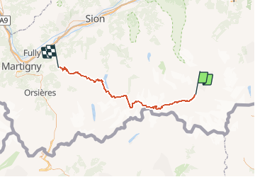


7.8 km | 25 km-effort


User


FREE GPS app for hiking
 SityTrail
IGN / Geographical institutes
SityTrail World
The world is yours!
Trail Winter sports of 61 km to be discovered at Valais/Wallis, Visp, Zermatt. This trail is proposed by maturin.
Ski de randonnée / Ski alpinisme....l''effort total. Course par patrouille de 3, organisé par l''armée suisse. Itinéraire préparé exclusivement à cette occasion (itinéraire de haute montagne)
Cela dépend beaucoup de l''entrainement : les meilleurs font le parcours en moins de 06h30, ma patrouille, 12h45 (soit, environ, le double).
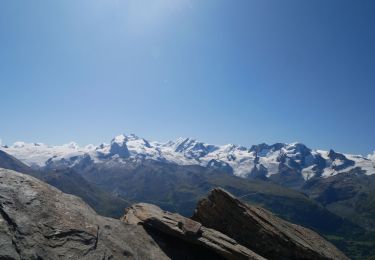
Souffrance physique et psychique sont au programme de cet effort. C''est une sorte de jouissance de voir la ligne d''arrivée.
Les passages les plus délicats, sans doute la descente depuis le col bertold à Arolla, de nuit.
On foot

Other activity
Other activity

Walking
Other activity

Cycle
Mountain bike
Walking