Trail Walking Lanarce - lanarce la villa te par - Photo

lanarce la villa te par

© OpenStreetMap contributors
Length
Length
17 km
Max alt
Max alt
1305 m
Uphill gradient
Uphill gradient
462 m
Km-Effort
Km-Effort  
23 km
Min alt
Min alt
1097 m
Downhill gradient
Downhill gradient
460 m
Boucle
Boucle
Yes
Creation date :
2020-09-18 07:13:12.382
Updated on :
2020-09-18 15:46:16.99

(1 Reviews)

Walking
Walking
4h50
Difficulty : Medium

Scan this QR Code to open this trail in the SityTrail application

FREE GPS app for hiking

Logo SityTrail SityTrail

IGN / Geographical institutes

Download SityTrail from the App Store Download SityTrail from Google Play

Logo SityTrail SityTrail World

The world is yours!

Download SityTrail from the App Store Download SityTrail from Google Play Download SityTrail on Huawei AppGallery

About

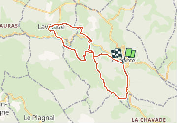
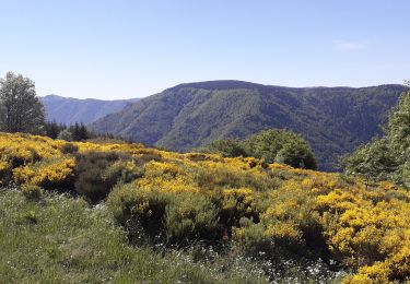
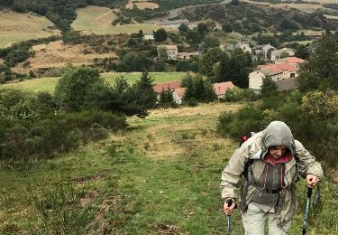
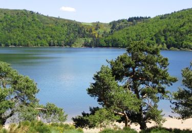
Trail Walking of 17 km to be discovered at Auvergne-Rhône-Alpes, Ardèche, Lanarce. This trail is proposed by mamoune07.

Elevation profile

Positioning

Country:
France
Region :
Auvergne-Rhône-Alpes
Department/Province :
Ardèche
Municipality :
Lanarce
Location:
Unknown
Start:(UTM)
579497 ; 4952947 (31T) N.

Comments

Please log in to post a review or rate the element


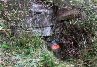
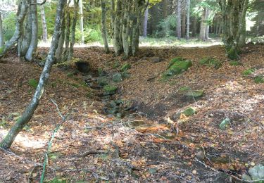
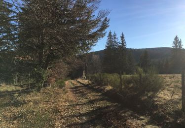
très beau parcours très nature et sans trop de route, super


Trails nearby

Trail Walking Astet - Col de la Chavade-Banne-Source de l'Ardèche V3 - Photo
Walking
Lustou

Walking

Astet, Auvergne-Rhône-Alpes, Ardèche, France
8 km | 10.6 km-effort
3h 0min
Yes
Trail Walking Astet - Col de la Chavade-Banne-Source de l'Ardèche V2 - Photo
Walking
Lustou

Walking

Astet, Auvergne-Rhône-Alpes, Ardèche, France
5.4 km | 7.1 km-effort
3h 0min
Yes
Trail Walking Astet - La Chavade - La Resse - Photo
Walking
Lustou

Walking

Medium
Astet, Auvergne-Rhône-Alpes, Ardèche, France
7.8 km | 10.2 km-effort
2h 19min
Yes
Trail Walking Astet - Col de la Chavade-Banne-Source de l'Ardèche - Photo
Walking
Lustou

Walking

Astet, Auvergne-Rhône-Alpes, Ardèche, France
10.2 km | 14.3 km-effort
3h 0min
Yes
Trail Walking Astet - Astet - Photo
Walking
damienrival

Walking

Very easy
Astet, Auvergne-Rhône-Alpes, Ardèche, France
18.4 km | 29 km-effort
5h 30min
Yes
Trail Walking Mazan-l'Abbaye - s'y cirgues en montagne - Photo
Walking
marquet

Walking

Easy
Mazan-l'Abbaye, Auvergne-Rhône-Alpes, Ardèche, France
17.2 km | 23 km-effort
4h 27min
No
Trail Equestrian Mazan-l'Abbaye - Boucle Le Bouteirou - Mont Gerbier de Jonc - Etape 1 - Photo
Equestrian
tracegps

Equestrian

Medium
Mazan-l'Abbaye, Auvergne-Rhône-Alpes, Ardèche, France
30 km | 42 km-effort
4h 30min
No
Trail Mountain bike Mazan-l'Abbaye - Boucle Le Bouteirou - Mont Gerbier de Jonc - Etape 1 - Photo
Mountain bike
tracegps

Mountain bike

Medium
Mazan-l'Abbaye, Auvergne-Rhône-Alpes, Ardèche, France
30 km | 42 km-effort
3h 0min
No
Trail Walking Mazan-l'Abbaye - Boucle Le Bouteirou - Mont Gerbier de Jonc - Etape 1 - Photo
Walking
tracegps

Walking

Difficult
Mazan-l'Abbaye, Auvergne-Rhône-Alpes, Ardèche, France
30 km | 42 km-effort
6h 30min
No


Close
My subscriptions