


2020-09-20_19h13m10_castellane , Trigance

gerardmicheline
User
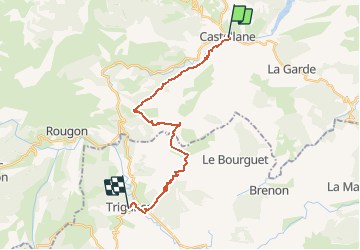

Length
20 km

Max alt
1182 m

Uphill gradient
812 m
Km-Effort
31 km

Min alt
706 m

Downhill gradient
770 m
Boucle
No
Creation date :
2020-09-20 17:13:10.909
Updated on :
2020-09-20 17:13:16.083

FREE GPS app for hiking
 SityTrail
IGN / Geographical institutes
SityTrail Plus
The world is yours!
About
Trail of 20 km to be discovered at Provence-Alpes-Côte d'Azur, Alpes-de-Haute-Provence, Castellane. This trail is proposed by gerardmicheline.
Positioning
Country:
France
Region :
Provence-Alpes-Côte d'Azur
Department/Province :
Alpes-de-Haute-Provence
Municipality :
Castellane
Location:
Unknown
Start:(Dec)
Start:(UTM)
300142 ; 4857771 (32T) N.
Comments