Trail Walking Orcival - GR 441 boucle de La chaîne des puys  - Photo

GR 441 boucle de La chaîne des puys

© OpenStreetMap contributors
Length
Length
119 km
Max alt
Max alt
1224 m
Uphill gradient
Uphill gradient
2702 m
Km-Effort
Km-Effort  
155 km
Min alt
Min alt
553 m
Downhill gradient
Downhill gradient
2700 m
Boucle
Boucle
Yes
Creation date :
2020-09-17 15:49:20.0
Updated on :
2020-09-22 10:51:57.377

(0 Reviews)

Walking
Walking
34h15
Difficulty : Easy

Scan this QR Code to open this trail in the SityTrail application

FREE GPS app for hiking

Logo SityTrail SityTrail

IGN / Geographical institutes

Download SityTrail from the App Store Download SityTrail from Google Play

Logo SityTrail SityTrail World

The world is yours!

Download SityTrail from the App Store Download SityTrail from Google Play Download SityTrail on Huawei AppGallery

About

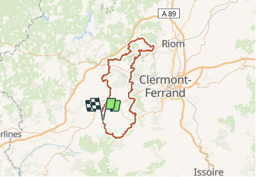
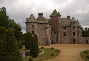
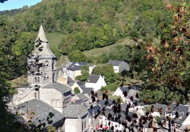
Trail Walking of 119 km to be discovered at Auvergne-Rhône-Alpes, Puy-de-Dôme, Orcival. This trail is proposed by zefreefly.

Description

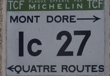
Cette boucle suit en majorité le GR 441 avec quelques variantes
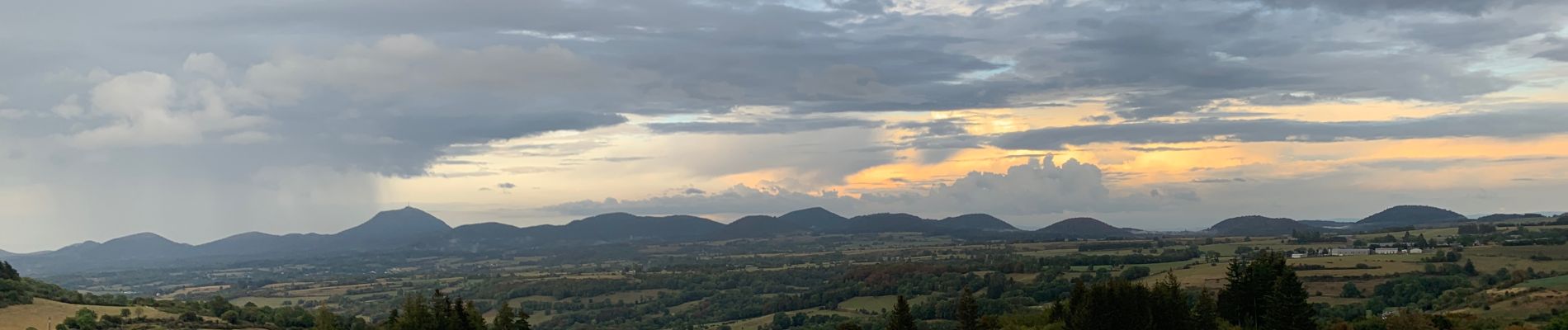
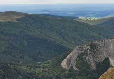
Facile mais quelques passages raides. Nous sommes en Auvergne quand même.
Ravitaillez en eau a chaque occasion.

Elevation profile

Photos

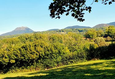
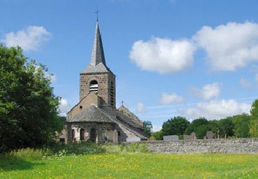
33 photos in total. Please click on a photo to see them all in the gallery.

Positioning

Country:
France
Region :
Auvergne-Rhône-Alpes
Department/Province :
Puy-de-Dôme
Municipality :
Orcival
Location:
Unknown
Start:(UTM)
487689 ; 5058865 (31T) N.

Trails nearby

Trail Walking Orcival - Lac de Servières à partir du Café du Lac - Photo
Walking
Dalma Chuck

Walking

Medium
(1)
Orcival, Auvergne-Rhône-Alpes, Puy-de-Dôme, France
6.6 km | 9.5 km-effort
2h 9min
Yes
Trail Walking Saint-Bonnet-près-Orcival - St_Bonnet_Orcival_Sioule - Photo
Walking
GUIDE
jagarnier

Walking

Easy
(1)
Saint-Bonnet-près-Orcival, Auvergne-Rhône-Alpes, Puy-de-Dôme, France
9.4 km | 11.8 km-effort
2h 45min
Yes
Trail Walking Saint-Pierre-Roche - St_Pierre_Roche_Sioulot - Photo
Walking
GUIDE
jagarnier

Walking

Easy
(1)
Saint-Pierre-Roche, Auvergne-Rhône-Alpes, Puy-de-Dôme, France
10.7 km | 13.2 km-effort
2h 51min
Yes
Trail On foot Saint-Pierre-Roche - Le Sioulot - Photo
On foot
PRO

On foot

Easy
Saint-Pierre-Roche, Auvergne-Rhône-Alpes, Puy-de-Dôme, France
10 km | 12.3 km-effort
2h 47min
No
Trail On foot Rochefort-Montagne - Le Puy d'Ebert - Photo
On foot
PRO

On foot

Easy
Rochefort-Montagne, Auvergne-Rhône-Alpes, Puy-de-Dôme, France
9.4 km | 12.3 km-effort
2h 47min
No
Trail On foot Orcival - Bois des Bourelles - Photo
On foot
PRO

On foot

Easy
Orcival, Auvergne-Rhône-Alpes, Puy-de-Dôme, France
6.9 km | 10.1 km-effort
2h 17min
Yes
Trail Walking Orcival - Serviere_Aiguiller_T - Photo
Walking
force

Walking

Difficult
Orcival, Auvergne-Rhône-Alpes, Puy-de-Dôme, France
12.2 km | 17.2 km-effort
2h 46min
Yes
Trail Walking Orcival - Orcival_Bois_Bourelles - Photo
Walking
GUIDE
jagarnier

Walking

Easy
Orcival, Auvergne-Rhône-Alpes, Puy-de-Dôme, France
6.9 km | 10.1 km-effort
2h 0min
Yes
Trail Walking Nébouzat - Nébouzat_Cascade_Saliens - Photo
Walking
GUIDE
jagarnier

Walking

Medium
Nébouzat, Auvergne-Rhône-Alpes, Puy-de-Dôme, France
13 km | 17 km-effort
3h 45min
Yes


Close
My subscriptions