


rimbach

gerard70
User
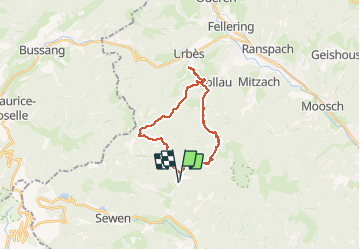

Length
22 km

Max alt
1102 m

Uphill gradient
1133 m
Km-Effort
37 km

Min alt
471 m

Downhill gradient
1134 m
Boucle
Yes
Creation date :
2020-09-22 06:47:17.574
Updated on :
2020-09-22 18:58:39.605
8h43
Difficulty : Difficult

FREE GPS app for hiking
 SityTrail
IGN / Geographical institutes
SityTrail Plus
The world is yours!
About
Trail Walking of 22 km to be discovered at Grand Est, Haut-Rhin, Rimbach-près-Masevaux. This trail is proposed by gerard70.
Positioning
Country:
France
Region :
Grand Est
Department/Province :
Haut-Rhin
Municipality :
Rimbach-près-Masevaux
Location:
Unknown
Start:(Dec)
Start:(UTM)
346581 ; 5298807 (32T) N.
Comments