Trail Walking Rabat-les-Trois-Seigneurs - Rochers Carlong - Photo
© OpenStreetMap contributors
Length
Length
11.5 km
Max alt
Max alt
1137 m
Uphill gradient
Uphill gradient
631 m
Km-Effort
Km-Effort  
19.9 km
Min alt
Min alt
639 m
Downhill gradient
Downhill gradient
632 m
Boucle
Boucle
Yes
Creation date :
2020-09-24 15:59:05.858
Updated on :
2020-09-24 16:03:42.953

(0 Reviews)

Walking
Walking
4h03
Difficulty : Difficult

Scan this QR Code to open this trail in the SityTrail application

FREE GPS app for hiking

Logo SityTrail SityTrail

IGN / Geographical institutes

Download SityTrail from the App Store Download SityTrail from Google Play

Logo SityTrail SityTrail World

The world is yours!

Download SityTrail from the App Store Download SityTrail from Google Play Download SityTrail on Huawei AppGallery

About

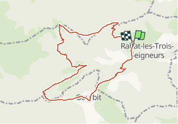
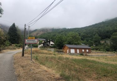
Trail Walking of 11.5 km to be discovered at Occitania, Ariège, Rabat-les-Trois-Seigneurs. This trail is proposed by c.chehere.

Description

Parking au lieu dit Contract.
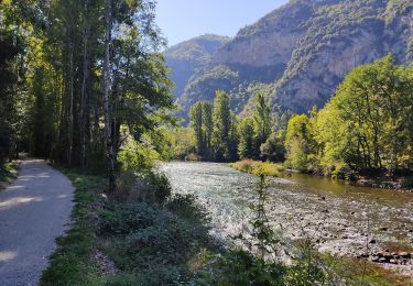
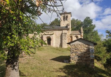
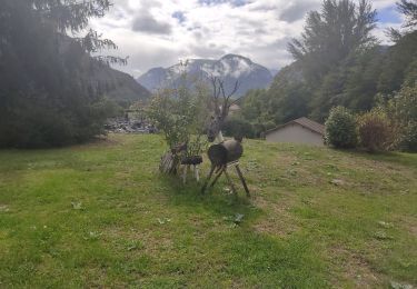
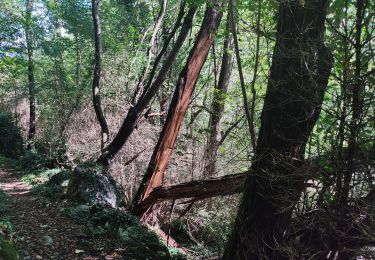
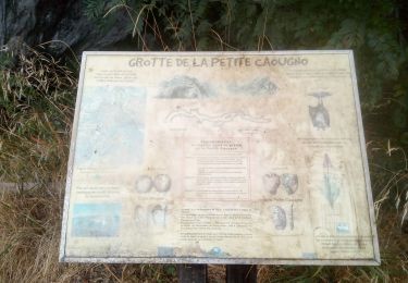
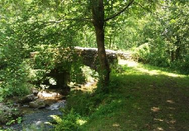
Très bons sentiers parfaitement balisés

Elevation profile

Positioning

Country:
France
Region :
Occitania
Department/Province :
Ariège
Municipality :
Rabat-les-Trois-Seigneurs
Location:
Unknown
Start:(UTM)
381371 ; 4745897 (31T) N.

Trails nearby

Trail Walking Gourbit - 04/06/2014 Rando Etang d'Artax - Photo
Walking
chrisbal

Walking

Difficult
(1)
Gourbit, Occitania, Ariège, France
10.8 km | 24 km-effort
2h 53min
Yes
Trail Walking Tarascon-sur-Ariège - De Tarascon sur Ariège aux Cabannes  - Photo
Walking
c.chehere

Walking

Medium
Tarascon-sur-Ariège, Occitania, Ariège, France
13.8 km | 17.1 km-effort
5h 4min
No
Trail Walking Tarascon-sur-Ariège - Tour de la pique de Tarrascon - Photo
Walking
c.chehere

Walking

Medium
Tarascon-sur-Ariège, Occitania, Ariège, France
11.9 km | 19.3 km-effort
5h 46min
Yes
Trail Walking Surba - Tour du roc de Sédour - Photo
Walking
c.chehere

Walking

Easy
Surba, Occitania, Ariège, France
13.1 km | 19.5 km-effort
4h 10min
Yes
Trail Electric bike Niaux - Niaux  - Photo
Electric bike
jpborto

Electric bike

Very easy
Niaux, Occitania, Ariège, France
13.8 km | 21 km-effort
51min
Yes
Trail On foot Gourbit - Étang d'Artax - Photo
On foot
PRO

On foot

Easy
Gourbit, Occitania, Ariège, France
4.3 km | 12.3 km-effort
2h 47min
No
Trail Walking Quié - le dolmen de la plagne - Photo
Walking
c.chehere

Walking

Medium
Quié, Occitania, Ariège, France
12.7 km | 21 km-effort
5h 40min
Yes
Trail Walking Niaux - Niaux  - Photo
Walking
c.chehere

Walking

Easy
Niaux, Occitania, Ariège, France
12.2 km | 21 km-effort
3h 20min
Yes
Trail Walking Gourbit - Gourbit- rochers Carlong - Photo
Walking
pidjam

Walking

Medium
Gourbit, Occitania, Ariège, France
11.1 km | 19.7 km-effort
4h 15min
Yes


Close
My subscriptions