Trail Walking Montperreux - Sentier de la découverte - Chaon Malbuisson - Photo

Sentier de la découverte - Chaon Malbuisson

 helmut68
helmut68

User

© OpenStreetMap contributors
Length
Length
9.8 km
Max alt
Max alt
904 m
Uphill gradient
Uphill gradient
186 m
Km-Effort
Km-Effort  
12.3 km
Min alt
Min alt
846 m
Downhill gradient
Downhill gradient
185 m
Boucle
Boucle
Yes
Creation date :
2020-10-01 08:49:59.55
Updated on :
2020-10-03 20:45:15.565

(0 Reviews)

Walking
Walking
2h12
Difficulty : Easy

Scan this QR Code to open this trail in the SityTrail application

FREE GPS app for hiking

Logo SityTrail SityTrail

IGN / Geographical institutes

Download SityTrail from the App Store Download SityTrail from Google Play

Logo SityTrail SityTrail World

The world is yours!

Download SityTrail from the App Store Download SityTrail from Google Play Download SityTrail on Huawei AppGallery

About

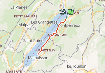
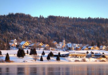
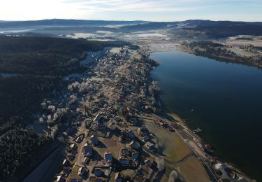
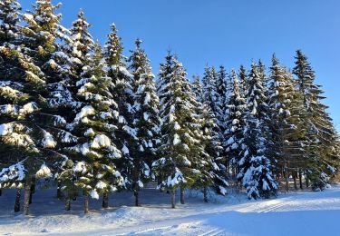
Trail Walking of 9.8 km to be discovered at Bourgogne-Franche-Comté, Doubs, Montperreux. This trail is proposed by helmut68.

Description

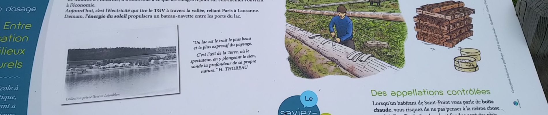
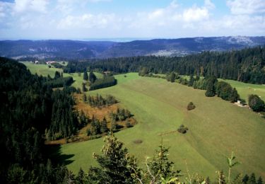
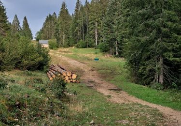
C'est une partie du circuit du Lac de St Point (A/R)  au bord de l'eau ou l'on peut observer foulques , hérons cendrés  ou canards sauvages , ... Le long de l'itinéraire des panneaux évoquent l'histoire, la géographie et la vie dans la vallée des Lacs .
Alors à vos chaussures !

Elevation profile

Photos

Positioning

Country:
France
Region :
Bourgogne-Franche-Comté
Department/Province :
Doubs
Municipality :
Montperreux
Location:
Unknown
Start:(UTM)
296966 ; 5189806 (32T) N.

Trails nearby

Trail Walking Les Fourgs - Le Stratégique - Doubs - Photo
Walking
tracegps

Walking

Medium
(1)
Les Fourgs, Bourgogne-Franche-Comté, Doubs, France
8.3 km | 10.6 km-effort
2h 45min
Yes
Trail Walking Les Fourgs - 2024-01-31_00h34m12_le-belvedere-de-la-roche-sarrasine_randonnee-2285212 - Photo
Walking
daniellebou

Walking

Difficult
(1)
Les Fourgs, Bourgogne-Franche-Comté, Doubs, France
12.4 km | 17 km-effort
3h 51min
Yes
Trail Walking Saint-Antoine - Boucle du fort St Antoine  - Photo
Walking
mallovon

Walking

Medium
Saint-Antoine, Bourgogne-Franche-Comté, Doubs, France
4.8 km | 6.2 km-effort
1h 25min
Yes
Trail On foot Saint-Point-Lac - La Ronde des Deux Villages - Photo
On foot
PRO

On foot

Easy
Saint-Point-Lac, Bourgogne-Franche-Comté, Doubs, France
5.5 km | 7.3 km-effort
1h 40min
Yes
Trail On foot Les Grangettes - La Pierre qui Tourne - Photo
On foot
PRO

On foot

Easy
Les Grangettes, Bourgogne-Franche-Comté, Doubs, France
8.2 km | 10.7 km-effort
2h 25min
Yes
Trail On foot Malpas - Le Tour du Lac de Malpas - Photo
On foot
PRO

On foot

Easy
Malpas, Bourgogne-Franche-Comté, Doubs, France
4.9 km | 5.7 km-effort
1h 17min
Yes
Trail On foot Malbuisson - Sentier du Tour du Lac - Photo
On foot
PRO

On foot

Easy
Malbuisson, Bourgogne-Franche-Comté, Doubs, France
16 km | 19.9 km-effort
4h 30min
No
Trail Nordic walking Malbuisson - Fort St Antoine  - Photo
Nordic walking
mallovon

Nordic walking

Easy
Malbuisson, Bourgogne-Franche-Comté, Doubs, France
5.8 km | 7.3 km-effort
2h 21min
Yes
Trail Cross-country skiing Les Hôpitaux-Vieux - Les Essarts - Photo
Cross-country skiing
mallovon

Cross-country skiing

Easy
Les Hôpitaux-Vieux, Bourgogne-Franche-Comté, Doubs, France
6.5 km | 8.1 km-effort
2h 3min
Yes


Close
My subscriptions