Trail Walking Mackwiller - mackwiller - Photo
© OpenStreetMap contributors
Length
Length
17.3 km
Max alt
Max alt
332 m
Uphill gradient
Uphill gradient
338 m
Km-Effort
Km-Effort  
22 km
Min alt
Min alt
224 m
Downhill gradient
Downhill gradient
337 m
Boucle
Boucle
Yes
Creation date :
2014-12-10 00:00:00.0
Updated on :
2014-12-10 00:00:00.0

(0 Reviews)

Walking
Walking
3h08
Difficulty : Medium

Scan this QR Code to open this trail in the SityTrail application

FREE GPS app for hiking

Logo SityTrail SityTrail

IGN / Geographical institutes

Download SityTrail from the App Store Download SityTrail from Google Play

Logo SityTrail SityTrail World

The world is yours!

Download SityTrail from the App Store Download SityTrail from Google Play Download SityTrail on Huawei AppGallery

About

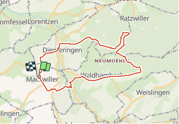
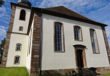
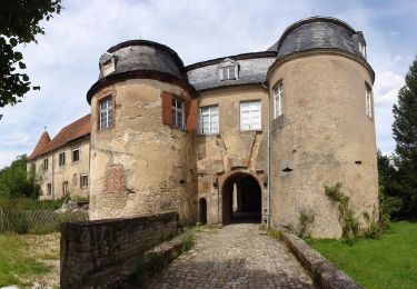
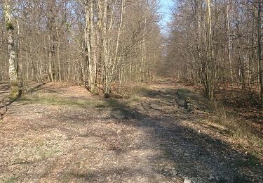
Trail Walking of 17.3 km to be discovered at Grand Est, Bas-Rhin, Mackwiller. This trail is proposed by cricrifran.

Description

16.03.2014

Elevation profile

Photos

Positioning

Country:
France
Region :
Grand Est
Department/Province :
Bas-Rhin
Municipality :
Mackwiller
Location:
Unknown
Start:(UTM)
366207 ; 5420913 (32U) N.

Trails nearby

Trail On foot Diemeringen - Mackwiller la romaine - Photo
On foot
PRO

On foot

Easy
Diemeringen, Grand Est, Bas-Rhin, France
4.6 km | 5.4 km-effort
1h 14min
Yes
Trail On foot Diemeringen - Croix bleue - Photo
On foot
PRO

On foot

Easy
Diemeringen, Grand Est, Bas-Rhin, France
12.3 km | 16.1 km-effort
3h 39min
No
Trail On foot Berg - Mémoire de pierres et d'eau - Photo
On foot
PRO

On foot

Easy
Berg, Grand Est, Bas-Rhin, France
3.3 km | 3.8 km-effort
51min
No
Trail On foot Diemeringen - Triangle bleu - Photo
On foot
PRO

On foot

Easy
Diemeringen, Grand Est, Bas-Rhin, France
7.6 km | 9.6 km-effort
2h 10min
No
Trail On foot Diemeringen - Comtesse Sophie de Nassau - Photo
On foot
PRO

On foot

Easy
Diemeringen, Grand Est, Bas-Rhin, France
6.9 km | 8.1 km-effort
1h 50min
Yes
Trail On foot Diemeringen - Yellow triangle - Photo
On foot
PRO

On foot

Medium
Diemeringen, Grand Est, Bas-Rhin, France
21 km | 27 km-effort
6h 11min
No
Trail Horseback riding Adamswiller - Boucle Adamswiller Kirschberg - Photo
Horseback riding
GUIDE+

Horseback riding

Medium
Adamswiller, Grand Est, Bas-Rhin, France
24 km | 30 km-effort
3h 53min
Yes
Trail Walking Mackwiller - mackwiller - Photo
Walking
cricrifran

Walking

Easy
(1)
Mackwiller, Grand Est, Bas-Rhin, France
10.4 km | 13.5 km-effort
1h 52min
Yes
Trail Cycle Berg - Villages welches (Tronçon Sud) - Wolsthof - Photo
Cycle
tracegps

Cycle

Difficult
Berg, Grand Est, Bas-Rhin, France
44 km | 54 km-effort
3h 30min
Yes


Close
My subscriptions