Trail Walking Allos - Col de l'Encombrette par Allos Retour Pas de l'Echelle - Photo

Col de l'Encombrette par Allos Retour Pas de l'Echelle

 GrouGary
GrouGary

User

© OpenStreetMap contributors
Length
Length
16.8 km
Max alt
Max alt
2540 m
Uphill gradient
Uphill gradient
841 m
Km-Effort
Km-Effort  
29 km
Min alt
Min alt
1499 m
Downhill gradient
Downhill gradient
1144 m
Boucle
Boucle
No
Creation date :
2020-10-25 07:19:42.961
Updated on :
2020-10-26 12:00:51.756

(0 Reviews)

Walking
Walking
7h22
Difficulty : Medium

Scan this QR Code to open this trail in the SityTrail application

FREE GPS app for hiking

Logo SityTrail SityTrail

IGN / Geographical institutes

Download SityTrail from the App Store Download SityTrail from Google Play

Logo SityTrail SityTrail World

The world is yours!

Download SityTrail from the App Store Download SityTrail from Google Play Download SityTrail on Huawei AppGallery

About

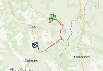
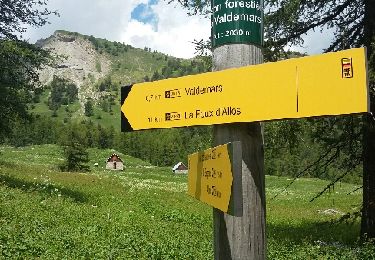
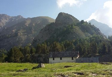
Trail Walking of 16.8 km to be discovered at Provence-Alpes-Côte d'Azur, Alpes-de-Haute-Provence, Allos. This trail is proposed by GrouGary.

Description

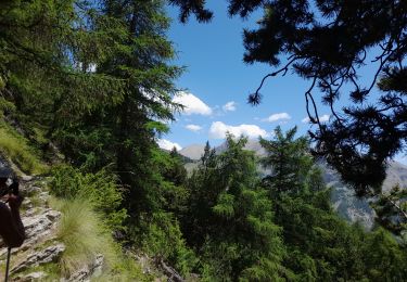
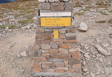
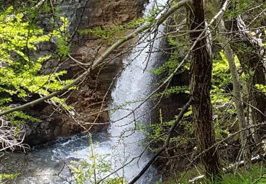
Magnifique boucle dans les mélèzes et érables flamboyants. Vues sur Grande Séolane, Mont Pelat, lac Allos et lacs de l'Encombrette.
Nombreux bouquetins peu farouches, chamois au col de l'Encombrette où l'approche se fait par une sente un peu enneigée.
Retour par l'adret plus chaud des lacs de l'Encombrette et les superbes zig zag du Pas de l'Echelle. Un dénivelé régulier mais long ;
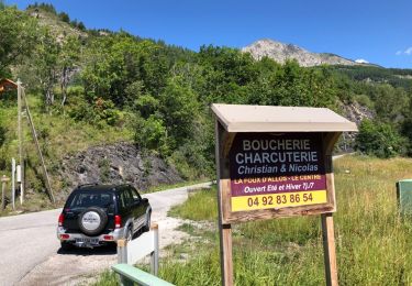
2 voitures parking Allos et Clignon Haut

Elevation profile

Photos

Positioning

Country:
France
Region :
Provence-Alpes-Côte d'Azur
Department/Province :
Alpes-de-Haute-Provence
Municipality :
Allos
Location:
Unknown
Start:(UTM)
313891 ; 4901940 (32T) N.

Trails nearby

Trail Walking Allos - le mont Pelat et le lac du trou de l'aigle - Photo
Walking
GUIDE
amiral13

Walking

Medium
Allos, Provence-Alpes-Côte d'Azur, Alpes-de-Haute-Provence, France
14.4 km | 27 km-effort
7h 19min
Yes
Trail Walking Allos - Allos:rando à partir de la Haute Colette - Photo
Walking
halgrain

Walking

Medium
Allos, Provence-Alpes-Côte d'Azur, Alpes-de-Haute-Provence, France
4 km | 7.7 km-effort
3h 48min
Yes
Trail Walking Allos - Col petite Cayolle-21-06-22 - Photo
Walking
Christiancordin

Walking

Medium
Allos, Provence-Alpes-Côte d'Azur, Alpes-de-Haute-Provence, France
11.8 km | 20 km-effort
3h 42min
Yes
Trail Walking Allos - le pelage.lac d'allos - Photo
Walking
Joel26400

Walking

Very difficult
Allos, Provence-Alpes-Côte d'Azur, Alpes-de-Haute-Provence, France
15.5 km | 28 km-effort
5h 44min
Yes
Trail Walking Allos - les lacs de la petite cayolle... - Photo
Walking
gibello

Walking

Easy
Allos, Provence-Alpes-Côte d'Azur, Alpes-de-Haute-Provence, France
31 km | 45 km-effort
6h 45min
No
Trail Walking Allos - lac d allos - Photo
Walking
Mariephil

Walking

Very easy
Allos, Provence-Alpes-Côte d'Azur, Alpes-de-Haute-Provence, France
12.3 km | 19.8 km-effort
4h 49min
Yes
Trail 4x4 Allos - Piste de Bouchier - Photo
4x4
pascal06300

4x4

Very easy
Allos, Provence-Alpes-Côte d'Azur, Alpes-de-Haute-Provence, France
3.6 km | 5.8 km-effort
Unknown
No
Trail Walking Allos - MF de Valdemars - Photo
Walking
LtZIP

Walking

Medium
Allos, Provence-Alpes-Côte d'Azur, Alpes-de-Haute-Provence, France
14 km | 21 km-effort
4h 24min
Yes
Trail Walking Allos - Les Lacs de la Petite Cayolle, des Garrets et d' Allos - Photo
Walking
LtZIP

Walking

Medium
Allos, Provence-Alpes-Côte d'Azur, Alpes-de-Haute-Provence, France
14.9 km | 24 km-effort
4h 52min
Yes


Close
My subscriptions