Trail Walking Mello - chateau et étangs de Mello - Photo

chateau et étangs de Mello

 doloop
doloop

User

© OpenStreetMap contributors
Length
Length
9.8 km
Max alt
Max alt
102 m
Uphill gradient
Uphill gradient
136 m
Km-Effort
Km-Effort  
11.6 km
Min alt
Min alt
33 m
Downhill gradient
Downhill gradient
136 m
Boucle
Boucle
Yes
Creation date :
2014-12-10 00:00:00.0
Updated on :
2014-12-10 00:00:00.0

(1 Reviews)

Walking
Walking
2h04
Difficulty : Unknown

Scan this QR Code to open this trail in the SityTrail application

FREE GPS app for hiking

Logo SityTrail SityTrail

IGN / Geographical institutes

Download SityTrail from the App Store Download SityTrail from Google Play

Logo SityTrail SityTrail World

The world is yours!

Download SityTrail from the App Store Download SityTrail from Google Play Download SityTrail on Huawei AppGallery

About

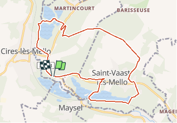
Trail Walking of 9.8 km to be discovered at Hauts-de-France, Oise, Mello. This trail is proposed by doloop.

Elevation profile

Positioning

Country:
France
Region :
Hauts-de-France
Department/Province :
Oise
Municipality :
Mello
Location:
Unknown
Start:(UTM)
454068 ; 5457371 (31U) N.

Comments

Please log in to post a review or rate the element


pas mal, chapelle magnifique, mais quelques endroits sales


Trails nearby

Trail Mountain bike Cires-lès-Mello - Cires-lès-Mello, coté Ouest - Photo
Mountain bike
tracegps

Mountain bike

Medium
Cires-lès-Mello, Hauts-de-France, Oise, France
58 km | 69 km-effort
3h 30min
Yes
Trail Walking Saint-Vaast-lès-Mello - 18 randonnée des carrières  - Photo
Walking
fitz2014

Walking

Difficult
Saint-Vaast-lès-Mello, Hauts-de-France, Oise, France
11 km | 12.9 km-effort
2h 49min
Yes
Trail Walking Cires-lès-Mello - Cires les Mello - Photo
Walking
Francine

Walking

Medium
Cires-lès-Mello, Hauts-de-France, Oise, France
12.7 km | 15.4 km-effort
3h 20min
Yes
Trail Walking Cires-lès-Mello - Cires les Mello - Photo
Walking
Francine

Walking

Medium
Cires-lès-Mello, Hauts-de-France, Oise, France
12.7 km | 15.4 km-effort
3h 20min
Yes
Trail Walking Blaincourt-lès-Précy - Blaincourt-lès-Précy PN - Photo
Walking
CC.RIDER

Walking

Easy
Blaincourt-lès-Précy, Hauts-de-France, Oise, France
17.3 km | 21 km-effort
4h 40min
Yes
Trail Walking Blaincourt-lès-Précy - Blaincourt-lès-Précy GP - Photo
Walking
CC.RIDER

Walking

Easy
Blaincourt-lès-Précy, Hauts-de-France, Oise, France
20 km | 24 km-effort
5h 17min
Yes
Trail Walking Blaincourt-lès-Précy - Blaincourt-lès-Précy GP - Photo
Walking
CC.RIDER

Walking

Easy
Blaincourt-lès-Précy, Hauts-de-France, Oise, France
20 km | 24 km-effort
5h 17min
Yes
Trail Nordic walking Montataire - Montataire 2 - Photo
Nordic walking
Francine

Nordic walking

Medium
Montataire, Hauts-de-France, Oise, France
10.7 km | 12.5 km-effort
2h 40min
Yes
Trail Nordic walking Montataire - Montataire 12k100 - Photo
Nordic walking
Francine

Nordic walking

Medium
Montataire, Hauts-de-France, Oise, France
11.7 km | 14.3 km-effort
2h 0min
Yes


Close
My subscriptions