


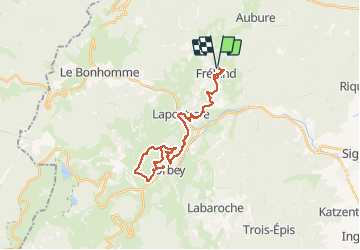
Orbey le lait via Faudé

duchaine.nicolas
User

Length
30 km

Max alt
678 m

Uphill gradient
953 m
Km-Effort
43 km

Min alt
415 m

Downhill gradient
955 m
Boucle
Yes
Creation date :
2020-12-13 10:37:25.726
Updated on :
2020-12-19 19:12:43.56
2h52
Difficulty : Medium
2h52
Difficulty : Very easy

FREE GPS app for hiking
 SityTrail
IGN / Geographical institutes
SityTrail Plus
The world is yours!
About
Trail Mountain bike of 30 km to be discovered at Grand Est, Haut-Rhin, Fréland. This trail is proposed by duchaine.nicolas.
Positioning
Country:
France
Region :
Grand Est
Department/Province :
Haut-Rhin
Municipality :
Fréland
Location:
Unknown
Start:(Dec)
Start:(UTM)
365795 ; 5337184 (32U) N.
Comments